A group of the usual TOT gang was slated to run trailz at Robber's Cave State Park last Sunday. Due to me not considering the previously mentioned Run Tulsa Pink 5K, most of the trail running conglomerate bowed out so they could volunteer in helping set that race up. I was stubborn, and talked Russell to making the trip 120 miles south and east to run ~12 miles of single track.
 We hit Wilburton at 9:30 am, and remembered we needed to have a cooler of cold beverages waiting for us after the run. A Styrofoam box, a bag of ice, and a six pack of cheap beer later, we were properly packed and ready to run. Robber's Cave is a beautiful area, with the caves, two small lakes, and a river framed by tall pines and taller bluffs. We planned on running all the trailz, and basically do the outermost loop. I had navigated some of it a few years ago, and wanted to conquer the unknown--all of it.
The dam had water spilling over it, and the deep cold lake begged for pictures, and in this case, a short video.
From there, we ran north on the park road downstream to another small dam to cross to the south trail head. So, as you can see, we started our trip with wet feet.
 Not soaking wet though, as my shoes (Montrail Hardrocks--my old faves that just won't die) drain well.
 I was concerned that the top of the mossy dam would be slick, and the water could have been deep on either side. Wet cameras and iPhones would be a bad thing. But there was no slippage.
 Crossing the river, we began a long gradual climb. I remember this being a very steep hill, but this day it did not seem all that bad. The temps were in the low to mid 60s all day, with a steady breeze and bright blue skies. Perfect!!
 Following the river northward, we dropped back down to the other side of the dam shown in the video.
 A fall here would have been a disaster.
 Russell took a lot of the pictures. I have lost the charger to my Canon. My iPhone was doing a great job though. If I am in the pic, it's Russell taking it.
 The trailz were amazing--following the lake shore for about a half mile before veering away and eventually climbing a steep scramble to the top of the bluffs.
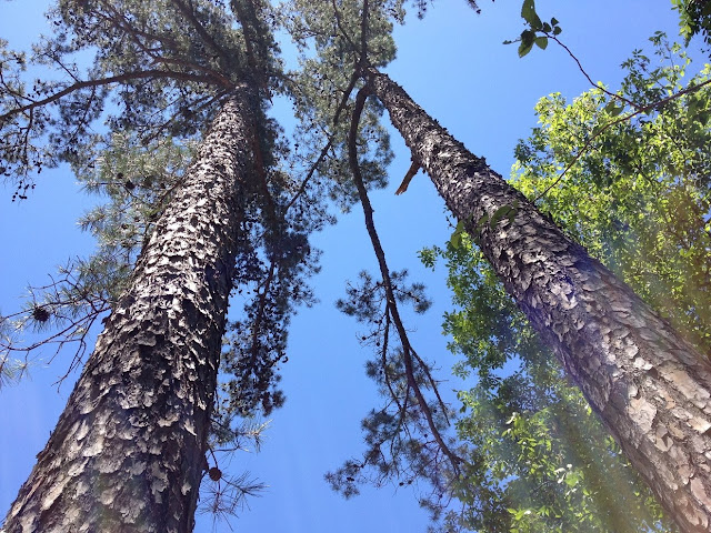
 The trail was tight single track, lots of rocks in places, and pine needles all day long. Love it love it!
 A last shot of an inlet in the lake before the climb.
 We tucked in under these sandstone overhangs, and then snaked right up the other side. There were 7-8 switchbacks as we ascended 200 feet in less than .2 miles.
 In a couple of places, it was a arms and legs workout to cover any distance at all. But after that climb, it was pretty tame for the rest of the day. Relatively flat, or something like that.
 The view from the top of the bluffs is worth the climb, although I think very few of the vacationers make the hike.
 The water is a lot farther away than it looks. You could not dive off these bluffs. Even throwing a rock does not hit the water.
 It's just amazing here.
 Russell on Inspiration Point. Does he look inspired?
 The trail was well marked--just follow the blue blazes.
 This brief section of trail is shared with our equestrian friends. Sometimes horse hoofs beat up a trail, but it was not bad here at all.
 We followed this stream off and on all day--or so it seemed. maybe it was different streams--not sure. I would have drank this water, if I had to. It seemed that clean. (Of course my luck, there would be a bear peeing just upstream.)
 Several small waterfalls.
 Russell got right up next to this one.
 We doubled up on this reptile who wanted no part of having his picture taken.
 We came to a junction about 7 miles into our run. I had my Nathan pack, and had plenty of water. Russell had one 24 oz water bottle and was low, so we took a shortcut to the caves where we could refill.
 Near the caves, there were lots of sight-seers. Folks there to see the caves, but staying in the parking lot because the trail up was too steep. After taking a couple of pics, eating a honey stinger waffle, and a Gu, we ran up the hill as a few tourists gawked.
 This is the north side of the huge boulders that make up Robbers Cave. No outlaws here today though.
 Russell and I headed to the northeast part of the big loop. We were at mile 9 and heading away from our start point. Russell thought we might have missed a turn. I doubted that at the time, but I still thought it best to take a gravel road that headed toward the right general direction of our car. This took us to the main park road (paved) and we ran 3+ miles southward to the camp office and our start point. These 3 miles were a gradual downhill all the way, and we cooked along at an 8 m/m pace. This brought our average pace back down to 17 m/m for the day--slow, but we were not in a hurry. We enjoyed a cold beer, and then headed back to Tulsa, but not before searching in vain for a good hamburger. A&W was a big disappointment. We made it back for the Run Tulsa Pink 5K.
I plan on going back to Robber's Cave in a few weeks. I want to run the loop in the opposite direction. I bet there are a good 20 miles of trail, and I need to see them.
 We hit Wilburton at 9:30 am, and remembered we needed to have a cooler of cold beverages waiting for us after the run. A Styrofoam box, a bag of ice, and a six pack of cheap beer later, we were properly packed and ready to run. Robber's Cave is a beautiful area, with the caves, two small lakes, and a river framed by tall pines and taller bluffs. We planned on running all the trailz, and basically do the outermost loop. I had navigated some of it a few years ago, and wanted to conquer the unknown--all of it.
The dam had water spilling over it, and the deep cold lake begged for pictures, and in this case, a short video.
From there, we ran north on the park road downstream to another small dam to cross to the south trail head. So, as you can see, we started our trip with wet feet.
 Not soaking wet though, as my shoes (Montrail Hardrocks--my old faves that just won't die) drain well.
 I was concerned that the top of the mossy dam would be slick, and the water could have been deep on either side. Wet cameras and iPhones would be a bad thing. But there was no slippage.
 Crossing the river, we began a long gradual climb. I remember this being a very steep hill, but this day it did not seem all that bad. The temps were in the low to mid 60s all day, with a steady breeze and bright blue skies. Perfect!!
 Following the river northward, we dropped back down to the other side of the dam shown in the video.
 A fall here would have been a disaster.
 Russell took a lot of the pictures. I have lost the charger to my Canon. My iPhone was doing a great job though. If I am in the pic, it's Russell taking it.
 The trailz were amazing--following the lake shore for about a half mile before veering away and eventually climbing a steep scramble to the top of the bluffs.
 The trail was tight single track, lots of rocks in places, and pine needles all day long. Love it love it!
 A last shot of an inlet in the lake before the climb.
 We tucked in under these sandstone overhangs, and then snaked right up the other side. There were 7-8 switchbacks as we ascended 200 feet in less than .2 miles.
 In a couple of places, it was a arms and legs workout to cover any distance at all. But after that climb, it was pretty tame for the rest of the day. Relatively flat, or something like that.
 The view from the top of the bluffs is worth the climb, although I think very few of the vacationers make the hike.
 The water is a lot farther away than it looks. You could not dive off these bluffs. Even throwing a rock does not hit the water.
 It's just amazing here.
 Russell on Inspiration Point. Does he look inspired?
 The trail was well marked--just follow the blue blazes.
 This brief section of trail is shared with our equestrian friends. Sometimes horse hoofs beat up a trail, but it was not bad here at all.
 We followed this stream off and on all day--or so it seemed. maybe it was different streams--not sure. I would have drank this water, if I had to. It seemed that clean. (Of course my luck, there would be a bear peeing just upstream.)
 Several small waterfalls.
 Russell got right up next to this one.
 We doubled up on this reptile who wanted no part of having his picture taken.
 We came to a junction about 7 miles into our run. I had my Nathan pack, and had plenty of water. Russell had one 24 oz water bottle and was low, so we took a shortcut to the caves where we could refill.
 Near the caves, there were lots of sight-seers. Folks there to see the caves, but staying in the parking lot because the trail up was too steep. After taking a couple of pics, eating a honey stinger waffle, and a Gu, we ran up the hill as a few tourists gawked.
 This is the north side of the huge boulders that make up Robbers Cave. No outlaws here today though.
 Russell and I headed to the northeast part of the big loop. We were at mile 9 and heading away from our start point. Russell thought we might have missed a turn. I doubted that at the time, but I still thought it best to take a gravel road that headed toward the right general direction of our car. This took us to the main park road (paved) and we ran 3+ miles southward to the camp office and our start point. These 3 miles were a gradual downhill all the way, and we cooked along at an 8 m/m pace. This brought our average pace back down to 17 m/m for the day--slow, but we were not in a hurry. We enjoyed a cold beer, and then headed back to Tulsa, but not before searching in vain for a good hamburger. A&W was a big disappointment. We made it back for the Run Tulsa Pink 5K.
I plan on going back to Robber's Cave in a few weeks. I want to run the loop in the opposite direction. I bet there are a good 20 miles of trail, and I need to see them.
No comments:
Post a Comment