Sunday, May 21, 2017

11 trail runners tackle Spavinaw WMA

For 5 consecutive weekends, I have done my semi-long runs with friends making road trips to run trailz we don't run all that often, and for most, ones they have never run.   Five weeks ago we visited lake Bixhoma and ran what single track is there, and then gravel and paved roads which conveniently included some hills. The heavy rains had some usually dormant waterfalls roaring, and it was quite a treat. The next week we ran at Keystone lake, doing a circuit on the mountain bike trailz and then a round at the state park on some entry level super easy routes. The next week we explored the newish mountain bike trailz at Claremore Lake, saw 7 snakes one of which was eating a rat, and collected a couple hundred ticks. Last week a few friends and I ran the Cavanal Killer 8K in Poteau. But we got there early and did a double-topper with almost 4000 feet of ascent. It's been fun, and our runs could legitimately be considered training--a novel concept for me. 

Today (Sunday if you are reading his over your Monday morning coffee) ten friends jumped on the bandwagon and we carpooled to Spavinaw to run some of the gravel access roads on the Wildlife Management Area (WMA).  

I've run there three times prior, and know the layout fairly well although I have not run every road and trail there. But from the ones that I DO know, I made a map showing a good selections or routes of various lengths. The map was a good map, but one of the roads that bisected the big north loop making a five-mile option was completely grown over and no one saw it. A few of our bunch was thinking of only doing a 5-miler, but everyone ended up with at least nine miles for the day. 

The day started going backward before we even started. I have run here before and never saw another human being all day. The Fischer family beat our caravan there by about 30 minutes and a park ranger informed them that we'd needed permits to be on the WMA. We could buy a two-day hunting or fishing license for 15 dollars or buy an annual one for $25. I had an expired one-year fishing license I'd bought last year so I could run at the Cookson WMA--and I bought it because the park ranger said I should have it. I have also ignored the requirement when I've run at the Sandy Sanders WMA where Do Wacka Do is and to my knowledge no game warden has ever shown up to check for illegals. But this ranger at Spavinaw seemed like a stickler to Christine, so they went ahead and signed u to fish. I advised the rest of our group to do the same. I bought the annual for $25, so I'm good anywhere in the state for a year. I think most of the rest of our group opted for the two-day license. Besides giving the State of Oklahoma around $200, we also burned at east an hour of our day.


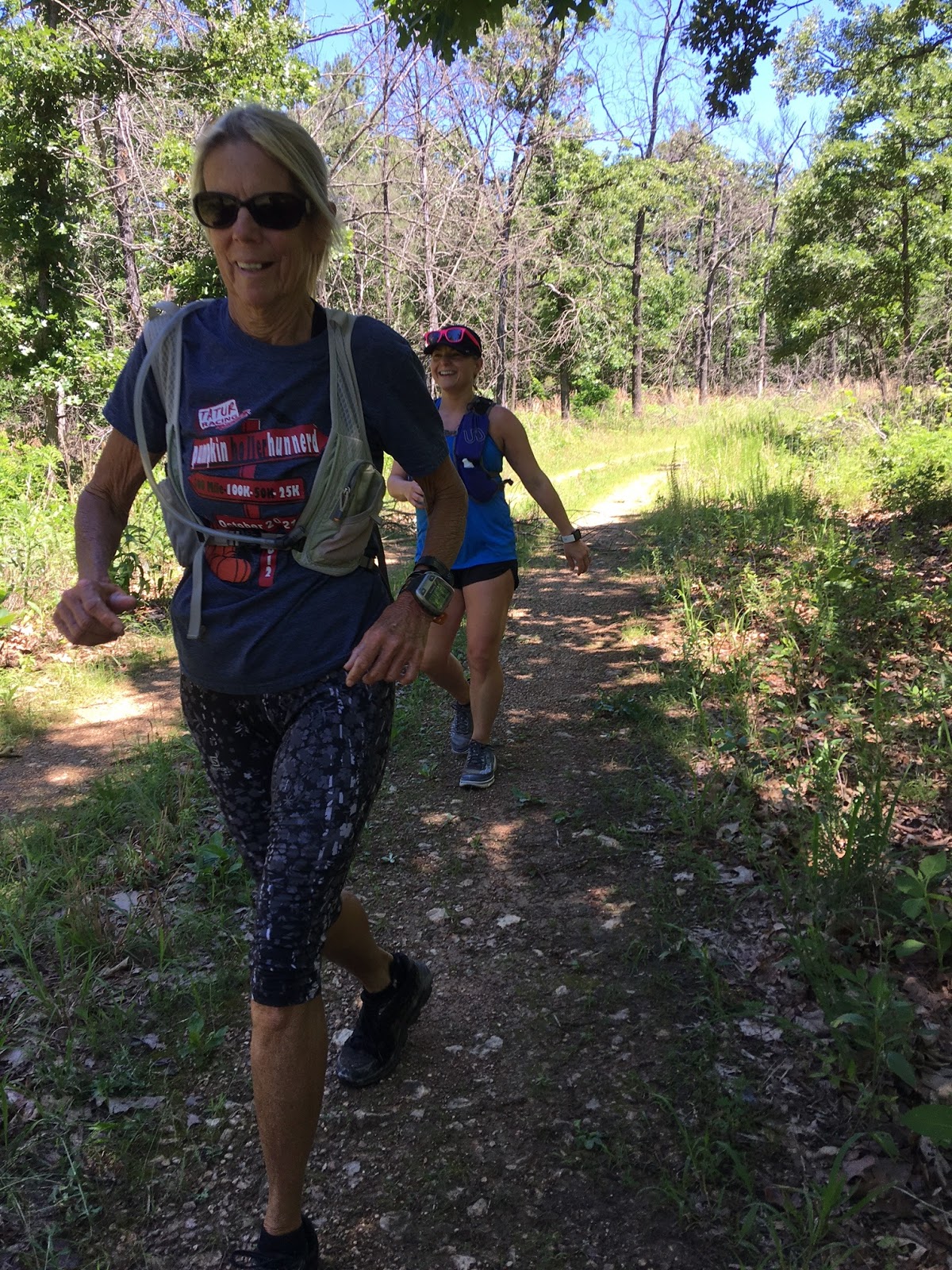
Nobody looked unhappy though. We scrunched in together for a group selfie and then ambled northward onto a primitive gravel road.

The Fisher family Christine, Josh, and Katy, along with Russell took off like a flash, and I just hoped my map was sufficient for them to find their way around.

The rest of us leap-frogged our way around the loop. After a mile and a quarter, the road made a sharp left turn and the climbing began. 

I had run 16 miles the day before, and I was moving at my usual zombie pace. My walking sticks kept my pace steady even on the uphills, and after a while, I caught up with the pack.

Jessy ran around like a kindergartner zooming down the hills, running back u, and then zooming down again. She also took it upon herself to coach us into running and leaping over fallen trees.

For most of the run, the roads were perfect, In the drought years we have had, these gravel roads are so hard they seem to eat your feet up--but recent rains had these roads cushy soft.

We reached an intersection that seemed to me like where those running 5 miles need to turn left. I veered right and soon we saw runners coming toward us. It was none other than the Fisher family and Russell. This incorrect road did not show up on my mapping app, and as I mentioned earlier, the road that should have created the 5-mile loop was non-existent. I knew for a fact that a couple of years ago this connecting road was open and well groomed. Oh well.

The group behind me met us at the intersection, and this looks like a real mutiny, but it didn't seem like one to me at the time--maybe it was.

From that point on, everything seemed real familiar to me and I never questioned our location on the WMA.

Jessy took off like a shot just eating this nice gradual downhill. I stretched it out and caught up with her for a while but backed off when the descent became a little steeper. I decided to run back to check on the last couple of runners. As we neared the bottom of the descent, we heard chattering voices, crazy laughter, and it sounded like a party going on.

Jessy found a log laying across a washed-out ravine, and was daring anyone to walk across it. I gave it a try but it had just a wee bit too much wiggle to chance falling 6 feet into the rocky dry creek bed, so I bailed. 

Jessy pranced across, then took the dare to cross another bigger tree laying at a 45-degree incline.

Lynna then tried her luck at crossing the semi-rotted out log, Everybody escaped unscathed.

Now we were out of the hills and into a long valley. Three miles (ok maybe four miles) was all that was between us and where we parked, or so I thought.

I was not at all surprised to see that we had a water crossing. No problem here--I was able to fly across.

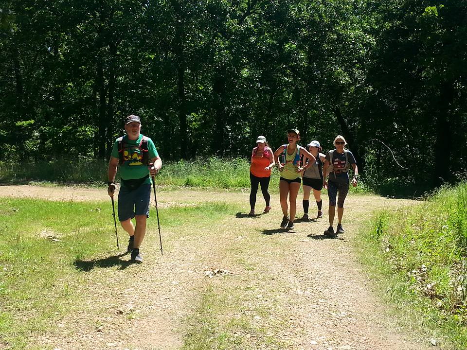
Well, this is our road. Russell and the fast group took this picture about an hour before we got there. 

The fisher plowed right on through it.

Russell evidently felt the shock of cold water. In places, the water was about the temperature of a nice nearly-freezing cold beer.

At first, our group was a bit tentative as to how they were going to cross through this area. 

I love a good water crossing--when it's not murky snaky foul smelling water. This stream was crystal clear--I would have drunk from it had I needed water.

So then the whole gang plowed in instead of trying to tramp through weeds alongside the creek.

It seemed like about a mile where there was more water walking than steps of dry land. 

From that point on, no one dreaded wet shoes--the almost icy water felt so good on our feet and legs. 

Water runs downhill, and we were walking upstream (or uphill) and eventually we ran out of water to tramp through.

But there had been some serious flooding here the past few weeks. This road washed out seems to be at least three feet thick. 

This waterfall ran over into a sink hole and who knows where it came out. 

We had our fair share of hills this day. The final climb actually started at the first water crossing and stretched for 3-ish miles ascending 350 feet. That doesn't seem all that bad, but 300 feet was in the last 1/4 mile.

I bit off chunks of the ascent and ran as much as I could. shuffling uphill is made so much easier with the trekking poles.

The final push--pretty steep, but runable if you're sick like that. 

A quarter mile down this hill put us back at the car. I did one run-back-up-and-down--technically a repeat. Russell, who finished way before my group did, did enough to legitimately call them repeats.

And of course, I love my Suunto and Strava data. I ended up with 1348 feet over 10.1 miles. This is a great place for training for a hard ultra. I will probably be back a couple of times before my fall 100. It'll most likely be heat-training since there is no running or hiking allowed during deer hunting season.But next tie I go, you should come with me.


Sunday, May 14, 2017

Killed Cavanal

Crazy ideas come to fruition when you hang around crazy people. My friend Tammy Cryer posted on Facebook looking for a 50K in the area in the month of May. There aren't many due mostly to temperatures rising as late spring rolls into summer. I mentioned out a couple of races in a 5-state area, and then threw a crazy idea of doing the Cavanal Killer--an 8K up Cavanal Hill in Poteau. This hefty hill has the distinction of being the World's Highest Hill, rising out of the plains 1999 feet which is one foot short of being a mountain. Last year I did the race, which includes close to 1900 feet of climb. The race has buses waiting to shuttle everyone back down to their cars, but I ran back. Yes, it's steep, and in places, I had to slow to a deliberate jog on the steep sections to keep from overstriding and keep my body upright. A fall on this old asphalt could easily leave a smear of human hamburger and just ruin your day. Still last year I had great fun running fast downhill for five miles. So simple math indicates that three ups and downs would be 30ish miles, and if we went back to the car each time for water refills and snacks, 31 miles would be no problem.
My GPS watch seems to slightly disagree with the altitude--no surprise here. It shows the hill to be actually 2359 feet. So maybe the hill rises 1999 feet from the plains below. That puts it short of 1999 feet, but maybe the actual point that the hill actually starts is somewhere other than the starting line on the race.

Tammy took the bait and was all in to run three ups and downs (repeats) and we recruited Bryan Carpenter to go and then Jana Graham and Christine Fisher--my teammates on the Cloudsplitter team. This race was to be our first official-ish training run for our super-tough 100-miler this October. Cavanal Hil can be seen several miles before getting to Poteau and is an impressive sight to see. (A bit of honesty here: I did a wee bit of finger-editing to the picture.)

We were shooting for a 6:30 start, completing an out and back, then running lap two with the race, and then doing another out and back to finish the day. We had a couple of runner fuel and potty stops on the way down and started a more like 6:40.


As usual, I could not pass up taking pictures on the way up. Bryan, Jana, Christine, and Katie got ahead early on.


I caught up with Bryan at the porta-pot and waited for him to emerge. My subsequent brief time there gave him another head start, and from there I didn't catch up with them until the second descent.


Two-ish miles in, the views of the wide open plains and distant mountains was magnificent. A heavy blanket of fog that set in looked more like an ocean.


In three places on the upward trek, the road descended across a saddle adding to the overall ascent. I remember griping about this last year, but I embraced it this time around.

I met Jana and Bryan as they were heading down when I was about a quarter mile from the top--not too far behind at all. That gave me a bit of kick in my step, and I powered all the way to the finish line whee the race timers were setting things up.

A quick selfie to prove I was there.


A view from the top--the clouds were beginning to burn off. At this point, I had 36 minutes to go a little over 5 miles back to the parking lot where packet pickup was. Christine agreed to get my race number and shirt--actually, I didn't really want the shirt but wanted to have my number so I could have an official time, but he folks at the packet pickup packed things away at the crack of 9:00 am and neither Christine or Tammy was allowed to get my packet. I also heard they would not let anyone pick up anyone's packet if they did not have the runners date of birth. :-/ So, although I paid an entry fee, I received no bib, no shirt, and no official time--but hey-- it's my fault for not making sure I was back in time. Again, I really didn't want the shirt or need the medal.


The downhill was great! I relaxed, stretched out my stride and ran the descent in 52 minutes. It felt so amazing loosen it up and run like the wind. I gave high fives and kudos to all the runners starting their race, telling them they look great (mostly true), they were almost there (a big lie), and that there was just one more hill (technically true.) I fully expected my quads to be screaming after the foolishness of running the steep downhills, but as of 11:30 this evening, I seem fine. 

Instead of running back to Tammy's car and taking a chance of being locked out anyway, I turned around at the starting line and worked hard to catch up with the last walkers and runners. This is a walker-friendly race and many folks come out and walk the whole way. Tammy spoke to several walkers who were doing their first race ever. What a rude awakening to have 1900 feet of ascent for your first race!!

Last year, I started also started the race late and had a fun time blowing by the back of the pack.  


Pretty soon I started seeing the quite a few finishers who opted to run back down to the starting line instead of taking the bus. Brandon and Cameron finished 8th and 14th and were just goofing around coming back down the hill. Upon looking at these pictures at home, I noticed Brandon has what looks like a growth on his left shoulder.


A growth? The Devil?     No--it's just Tammy. 

After my second ascent, I ran back a quarter mile or so and met Tammy so I could pace her to the top. Tammy had befriended a couple of ladies who were doing this event as their first ever race. She was coaching them along, was in very good spirits, so I decided to run back up to meet Bryan and Jana and join forces with them for the downhill portion. 

Bryan, Jana, and I ran most of the way back downhill for the second descent. It seemed kind of like a mutually agreed thing to stop after two out and backs. It was getting hot, and while the race was going on, we had aid stations every couple hundred yards, but there were none on our final descent, nor would there have been for the third up and down.

So I ended up with 21.5 miles, and 3967 feet of ascent. This was kick-ass training for our upcoming 100, and I can see doing this again before our October 100.


Sunday, May 7, 2017

Claremore Lake and new trailz (to us anyway)

For three weeks now, a group of dirt-loving friends and I have made trail trips to explore strange new worlds. This week we ended up in Claremore to run some new and newly revamped mountain bike trailz. I have known about the trails around happy Lake for a few years. They were a little overgrown at times, but in the past couple of years the local mountain bike groups have done some incredible improvements to the existing tracks, and have cut several miles of new ones alongside the shores f beautiful  Claremore lake.

Pictured above from let to right: Johnna, Jamey, BfkaM holding on to Blue who's head was chopped off by the picture taker (which was me), Steve, and Alicia hiding behind Steve.)
Our group met at RunnersWorld and carpooled/caravanned to the said location, where BfkaM and blue had gotten an early start and had all the spider webs cleared out of the way for us. We discussed our plan of attach, and decided to go counter clockwise and take all right turns and see how that worked out.
Early on, we ran along the shore of a finger of Claremore Lake, I figured if we were going to get into any mud, it would be here. There were just a few soft spots on these trails, which is a tribute to the trail designers.


Same spot, but looking the other way. We had talked early in the run as to whether we'd see more turtles or snakes. I decided to count a turtle we saw in the road just before getting to the parking area, so the turtles took an early lead. But a few minutes later, a shriek from Jamey indicated the score had been evened. I small green grass snake slithered into a thicket just ahead of my reaching hand. These guys are fun to play with, but he was having none of that. Jamey was on pins and needles for a while as she is terrified of snakes. All snakes. Poisonous snake non-poisonous snakes, baby snakes, dead snakes, and sticks that looked like snakes.


This little spillway is what separated Claremore Lake from Happy Lake. There was enough green slimy moss and water flowing over the top that we decided to not cross. I didn't think there was anything of interest over there anyway, but my Movescount app shows maybe a mile of trails on the other side--another trip forthcoming.


Next was the caves--actually more of a series of grotto and overhangs. There was some graffiti, names carved in the rocks, and remnants of parties past. Alicia says she lifts the rock up a few inches, but Johnna is not buying it.


Johnna's picture, but much like one I'd take.
We had bright blue skies, gentle breezes, and mid-70s to run on a perfect day. We ended up doing a big loop that basically skirted the outer boundaries and ended back at the parking lot. From there, we ran a series of winding, twisting trailz in the heart of the wooded 40-acre plot, and finished with 3.56 miles on my watch.


The plan from here was to check out the 4ish mile trail that ran along the shoes of Claremore Lake. This required running across a bridge with a narrow shoulder on either side. We switched sides several times as there was quite a bit of traffic for a road out in  the country.


Our snake/turtle count was 6 snakes to 3 turtles. I had hopes for a late surge by the turtles. Alicia swears the last snake she saw was THIS LONG!!


Johnna took this pic
Once we crossed the bridge, topped a short hill, and entered the trail, we knew we were in for a treat. This part of Claremore Lake was beautiful. The water on the other side of the bridge and Happy Lake was muddy, but the main body of Claremore Lake was evidently deeper and took the deep blue color of the sky. I took several pictures but none of mine were as good as this one of Johnna's.

We had not been on this trail for even a half mile when Steve, who was running ahead and then coming back to us, came back to me and said he may or may not have seen a snake eating a squirrel. Maybe my inner Steve Irwin, or maybe my inner redneck kicked into full gear and I hurried cautiously ahead with my camera in hand.


This was a sight to see right in the middle of the trail.  AT this point in the feeding ritual, it was determined that the dinner-to-be was indeed a rat, and the snake was still in the process of suffocating his victim. I took a step or two ahead, and he turned to greet me, and I got the idea that he'd bit me if I dared to mess with his brunch. Happy to back off, I retreated a step or two while the rest of our troop caught up. This was a narrow single track trail. To the right was a brier covered drop-off, and to the left was more briers and a fallen tree. And we needed to get through. We spent a good 10 minutes while the snake decided his dinner was dead enough and proceeded to eat.
And YES I got a video.


BfkaM took over the narration and sounded like a nerdy but enthusiastic elementary school science teacher. I have seen snakes feed before, and how their jaws unhinge and how the whole process in sometimes 30 minutes long, so I stopped the taping and we bushwhacked our way above the trail and headed on. Steve said he was really lucky he didn't step right into the middle of this dinner party. He would have possibly saved the rats life. He probably would have been paid back with a nasty bite, as rat snakes are a mean lot.

A couple hundred yards later, we ran into our friends Maddie and Victor who we had also seen at the parking lot. Cool to run on other friends from Tulsa with like interests They informed us that the trailz ahead were in great shape, and they went a long way. BONUS! We informed them that they had a feeding snake ahead.

The trail weaved through the thick woods and occasionally ran along the tops of bluffs overlooking the lake. There were a few ups and downs, but most was runnable and bikeable.


2.7 miles after leaving the older bike trails and the place we parked, we came to the end of the newly cut trailz. From here on to the dam we had a choice of running on the paved road or the narrow band of grass between the road and the lake. Not complaining here at all.


A couple of kayaks came paddling over to the shore where we were walking, and it was none other than Victor and Maddie. They had a great day of adventure as we did, and now I REALLY want a kayak.


We headed on to see what there was to see at the dam. BfkaM, Alicia, and Jamey had turned back about a mile past the snake and they were going to catch us wherever we ended up. We ran atop the levee all the way to the spillway and saw that down below there was a series of waterfalls. From our vantage point, I could see no trailz leading to the falls, but I bet there was a way. By the time we got back across the levee BfkaM, Jamey, and Alicia came driving up. Our running was done and lunch plans were brewing.


Our travels. If you click on the map, you can see some red dotted lines of other trailz that we did not run. The ones in the cluster if zigzags are not really of any interest to me, but the ones on the other side of the lake might be worth checking out. I am quite impressed with the work this mountain bike group has done.


Movescount has a better graphic, but Strava gave me more elevation Strava shows 525 feet of climb, and that could be right over 7 miles, which is what I ended up with for the day.

This is definitely a place I'll come again to run. Despite seeing seven snakes (I only saw three, but there were other sightings between the six of us), the main problem running here was the ticks. I has sprayed my legs, shoes, and socks heavily with 40% Deet, and I still had a few crawlers. All of us picked off a few ticks along the way and after our run. I took my shoes and socks off and heavily sprayed my bare feet, legs, saturated my socks and put them back on, and sprayed inside my shoes. Where there are ticks, there are probably chiggers. Hopefully I killed these little SOBs as well.