Showing posts with label Geocaching. Show all posts

Wednesday, May 28, 2014

Explaining a weird Facebook post

A Facebook post:
In a journey of 2 miles and thorns, I came upon an upside-down traveller with a shell on his back. I pondered righting his ship, but instead I did some writing on his underside. He was happy and content to stay belly side up, so I left him.
Then I began a quest for squirrel poop. I found a tree, and rummaged around in poop seeking a silver pill bottle and the contents inside. I searched until all of my nails were poop crusted, and gave up--but then I remembered a saying that was so simple but so complex--"Yes we did!" and then I knew where the silver pill bottle in the squirrel poop was.
I returned to the upside-down traveller before I returned home, and a green thorn brier named Karma paid me for my sins.

An explanation:

I had about an hour to get in a run, although I did not feel like running. Jake, however, thought a run was a GREAT idea. He knows when the running cargo shorts come out of the drawer that his chances are good. Then a running shirt enhances his excitement. The buzz of the Garmin as I turn it on sends him over the edge. He gets so worked up he jumps and dances (as well as a 105 lb lab can dance), grabs the leash and tries to actually walk himself. Then he realizes he must look silly, and then forgets he is looking silly and does it all again.


I had seen on geocaching.com that there were a couple of new geocaches not far from the parking lot at Turkey Mountain, and I could shuffle a little, find a couple of hidden gems, walk/run the dog, extend my "Mile a Day in May", and stay within the rules of the taper. Talk about multi-tasking!!! The first one was called Turkey Mountain Fauna. I headed up one popular trail and made a switchback down another, set my geocache app from "map" to "compass" and walked slowly until I was within 20 feet of ground zero and the supposed hide was exactly due east. Then, I proceeded into the thicket--knowing that there would be ticks and chiggers glad to see me.
This tree seemed to be the focal point. I looked in it, near the base, in the branches, and then made my way around it. Eventually, I found the prize. It was a clever hide. One that made me laugh and makes geocaching fun albeit silly at times. I make a rule to not give to much away when blogging about geocaching, but suffice to say that no creatures were hurt or were suffering in my journey. Except maybe my legs. I signed the log and entered my find on my iPhone Geocache app.


The second cache I hunted was called Squirrel Poop. The description of the cache warned that hunters might indeed find some squirrel poop in their search, which was a good hint in a way. I was about .3 of a mile away, and I shuffled my way over that direction. I know all the shortcuts from point A to point B, and we were there and very close in about 5 minutes.
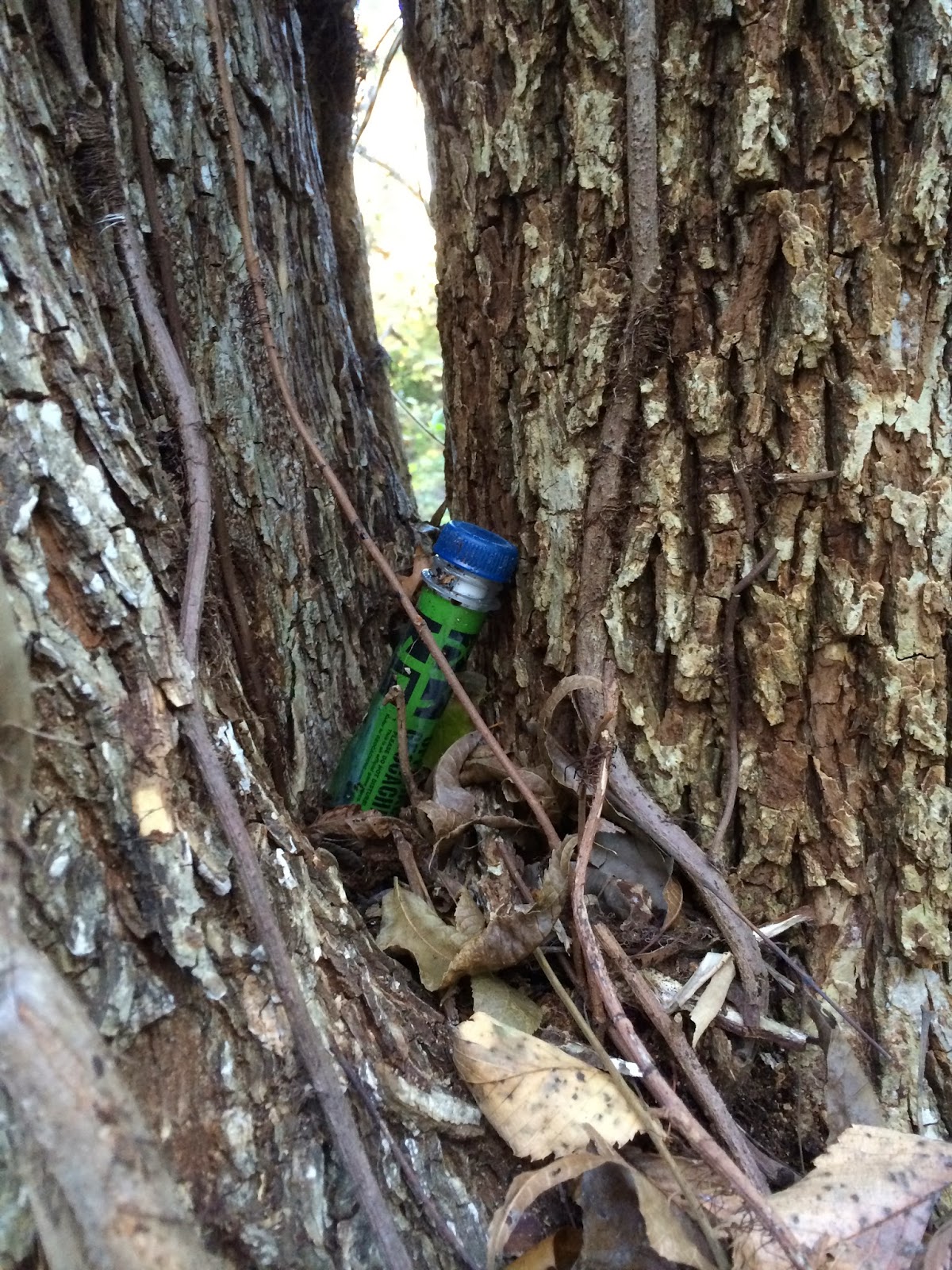
It sure seemed like the hide was somewhere in this tree. As I got closer, I was a long hollowed out log, and I peeked in--nothing. There was supposed to be a silver pill bottle in there somewhere. I reached in, and shuffled through the rotted wood, squirrel poop, and then thought of those 4 inch centipedes, and those 18" copperheads, and scorpions, and then flesh eating bacteria. SO, I reverted back to peeking in wherever I could. I did manage to pick up three ticks while searching. L looked all over, and was about to give up. You don't find them all. Then, I remembered the HINT in the description. The words "Yes we did!" made me look somewhere else, and required me to muster up all the dare-devilish behavior I could to get to a place where the cache could be accessed.  With the help of a keen eye, I spotted the cache. It was a good find. Yes, I did have dirt and/or squirrel poop under my fingernails. 

It was time to head home, and as I neared the parking lot, I told Jake to SIT so I could hook him up to his leash. Oops! I had lost his leash. Then I reasoned that I must have set it down when I wrote in the log at the first cache. I certainly did not remember folding it back up--so we headed back. I found it easily, and plowed in to get it. Yep--the leash was there and I zombie-vaulted over a log to get it--but laying in wait was a green rope saw brier waiting there since it was a sprout to shred my leg. Two short punctures, a 2 inch scratch, and a 4 inch gash made for a colorful display of blood. Was this "karma"? Maybe, maybe not. One of my FB friends called it "trail runner medals", and I like that. SO, after taking a leg selfie--nope that one was not good, and after taking three, and then Facebooking the best one, Jake and I headed home. As I stated on FB, Jake does not understand geocaching. Or selfies. But if it involves a little running, he tolerates it.

SO, now I have sort of explained my riddle/crazy FB post, and have not given away to much as to the secrets of the hides.

Sunday, December 29, 2013

Coin shooting and canslaw

I had mentioned to Fiver that I knew of an old house--maybe over 100 years old--that might be good for some MDing. Saturday would have been a good day, but I had Sunday open--so we bundled up and made a trip to Pumpkin Holler.

This is a route I have ran, and unless I was totally enamored with swinging the tector, I planned to tack on a few miles on here, and maybe do a little exploring.


Fiver brought Gavin, his son with a sharp pair of eyes, and a rationed amount of enthusiasm. We parked and walked about a mile mostly down a steep hill to a hidden gem of a house.


Fiver brought a spare machine for me to use, and I scanned the south side (the side that sheltered me from the cccold north wind.) My hopes were high when the beeps and buzzes lit up the air, telling me that a great treasure was merely a few inches below the surface, and a couple of shovel scoops away. I was a treasure hunter--a dirt fisher, a coin shooter in the making. A quick scoop into what turned out to be more rocks than dirt, revealed the inevitable--tin that once was the roof of the house. My detector was doing what it does best--signaling that there was buried metal--but not quite what I had dreamed of.

Meanwhile, Fiver and Gavin found a penny, a couple of pieces of a pistol (toy ones I think), a gate hinge, a gate latch, a few nails (he was well on the way to building a fence), and the face of a pocket watch. Hearing of his success gave me renewed interest, and I decided to go into the depths of this multi-level-by-decay house. Carefully I high-stepped my way around what was the crawl space, watching carefully for overly rotted rafters and pointy-side-up rusty nails. Near what was the clean-out for the fireplace, I hit the mother lode--I thought. Turns out, it was massive chunks of iron, but still, I dug around a little. Then, I SAW IT!! A round shiny silver disk--could it be an old quarter??? No.  It turned out to be a foil seal to some kind of bottle, and it chipped-tore as I picked it up. Damn!

Fiver pondered where a hundred year old house would have an outhouse, and we were looking around when he spotted moving objects  deeper in the woods. He said it was pigs. I thought bears. But since bears normally travel in packs of 15 or so, I agreed they were pigs.

SO, I put the metal detector and my digging tool down, and turned on my camera app. I didn't want to get to close, but still wanted a good pic. I took several, and most were too blurry. I was quiet, but when they noticed me, they ambled quickly away. There were 5-6 piglets, and momma pig(s) might have been protective, so I let them go. (I remember the Hannibal movie!)

Walking back, I noticed a road heading east behind the old house into the deep woods. BONUS!!


My Garmin was running on fumes, and I took off at a jog. Garmin died at .8 miles, and I continued on for about 4-5 more minutes. It seemed like each turn in the road invited me to see what was around the next bend. If this goes where I think it does, it'll hook into the road that goes north from the nature center and make a 6-7 mile loop. WINNING!!
Gavin was ready to go, and the three of us headed back up the hill to the truck. We did make a stop at an old abandoned campsite, and swung the tector for a few mins here. Dug two holes, found a piece of tin foil. Covered the holes back up and spread pie needles over the dirt. Leave no trace.


I decided to take the Pumpkin Holler loop via the NE side back to Eagle Bluff to show off our beautiful race course. Fiver--eagle eye that he is--spotted this natural bridge. I was astounded as I have drove by it maybe 100 times and not noticed it. Could be that there was not water in the stream before.

Cross with dry feet. Neato.


But the journey home was not yet underway. These structures (I thought the big one was a barn--and it probably is now) could have once been used by farmers with holes in their overalls pockets. Since I had found mostly canslaw for the day, I let the master do the detecting, and I stuck to taking pictures.


Would a barn have a level rock foundation and a raised wood floor? It might.


These boards wold not hold up a horse or cow. Yep--there's hay, but not a big door to load stacks of hay through.


And would a barn have a storm cellar nearby?
Just outside the cellar, Fiver was digging away. He had got a solid consist ant hit, and just knew there was something good just 8 inches down. He dug, scanned, dug, scanned. Fin bally, when it seemed he was about to dig another cellar, he struck what was a large metal object. A dig, a tug--and he unearthed an old rusty propane bottle. Not the treasure he was wanting, but he did take a nice haul home.
A few coins, a belt buckle, some unknown thingies, a face to a pocket watch, a key and a ring. He's good.

So, I thought I'd show pictures of my treasures as well.
It was still fun.

Saturday, November 30, 2013

Chandler Park with friends, metal detecting, and a surprize geocache

It all started with K2 posting something on Facebook. I wanted to run at Chandler Park (actually the WildWoods west of Chandler Park), and reading that K2 wanted someone to run 10ish miles with him led to an invite, and the plans were made. Terrianne had also responded to K2, and the three of us met in my driveway at 7:30 and left out to west Tulsa.

I started us out with an easy loop on the east side of the wilderness area, and I was a little disappointed to see that someone has been clearing land and making new roads. Some kind of development is forthcoming and I don't like it. But we got a little under three miles in before heading west to bigger hills and cooler trailz.

A lot of the trailz are actually double track (fancy-speak for two lane jeep roads) with some tight single track and some wide enough for 4-wheelers to maneuver through.


Terrianne and K2 wait for me--had to have a pee break. Shortly after that, we heard voices through the trees--kind of like something a fox would say if a fox could talk. And them lo and behold, Trail Jesus stood before us. TJ (aka John Nobles) was out with a few friends scoping out the course for a fat ass run called "The Worst Christmas Party Ever."
According to Cole Starkey, he and TJ
"have been spending the last few mornings on the trails. Every time we are out there my mind is blown, such variety and beauty throughout this otherwise unused trail system. It looks like we will be keeping our promise of using each trail only once to get to our 24. Will be going out Saturday and Sunday mornings as well if anyone wants to join in on the training and get a sneak-peek at this one-of-a-kind course."

The race supposedly finishes here--and if you are running and gunning it into the finish, you had better shut it down IMMEDIATELY after crossing the line. The first step past where Trail Jesus is standing is a big one.
The view from here is amazing. You can see forever (or all the way past Sand Springs, which is just like forever.)

From there, we went to the bottom of the 60' bluffs through a narrow slot between huge rocks.

I maintain that the earthquake a couple of years back caused these rocks to move closer together. I had to definitely turn sideways to get through. I even had to take off my Camelback. It could also be because I ate much dessert Thursday and again on Friday. As seen above, K2 also had to turn sideways. I offered him my BodyGlide to help with his passage but he made it without it.

I always like to take a different way out--just HATE going back the same way I came. I thought there was another trail that led out, and took great efforts to find it. But I finally gave in and we backtracked a 1/4 mile back the way we came. Next, it was the maze. Up on the upper plateau, there are jeep roads that just go on and on and on. The tall grass is 8' tall, and there are scrub trees, and persimmon trees, and BRIERS that are 8-10' tall, and you cannot see anything other than the gradually turning rutted out dirt roads. There are two ways out of this maze, and several turns that make giant one-mile circles. I was up here once late in the afternoon, and it got dark on me. I had a headlamp, but made three one mile circles before I found a way out. I DID not want to go in even ONE circle today, and was oh so careful to make sure I was making the correct turns. In one place we came onto a ginormous mud puddle with a swampy mud bog on either side of the road and man-eating briers licking their chops hoping we'd even try coming anywhere other than right through the middle of the mud. We turned around and took a road that I was sure a big circle going nowhere but where we had already been. But luckily, we found the road kept bearing south and it eventually came out on the Powerline. Good news.

This huge plot of undeveloped land has in years past been a good place for people to dump the cars they'd stolen and stripped--often setting them afire. Once on the Powerline, we saw one of these cars, stripped, burnt, and flipped over. The odd thing was that there was a brand new tarp tied to the back of the truck, and it appeared that someone had been living under the truck with the tarp serving as their enclosure. The remains of a campfire, a can opener and a few empty cans seemed to bear this out. Here, K2 takes a load off, relaxing as the inhabitants before him did.


We dropped down through a narrow hallway to get to the trailz that led eastward. Terrianne is still all smiles. She was a good sport.

This Powerline trail is about three miles long, and has longer and steeper climbs that Turkey Mountains Powerline trail. It seems like it's much further, and just when you think you've got to the top of a long climb, there is another 100 feet to climb.


There was a few groans once we topped what we though was our last limb, and saw we still had this.

Rather than going down the last hill, I took us north through the woods and on top of a ridge. This eliminated one downhill and uphill. I am sure we had done enough ups and downs. Besides, this is a nice trail.

One last climb, and it was flat all the way back to the park. We ended up with 9.7 miles, and took over 3 hours to do it. We had a few stops to chat with TJ, pee stops, and hey--it was not a race.

I love running here, except after a rain. I may go back tomorrow too. We'll see how my knee and ankle feel in the morning.

When I got home, I had a call from my brother Fiver, who wanted me to show him a couple of abandoned home-sites on Turkey, as well as the moonshine camp. He is into the metal detector thing, and wanted to see what kind of gold/silver coins he could find. I was glad to do that, and Jake was glad to go with me.

We hit the moonshine camp first, where there is a geocache hidden and I have not been able to find it despite having looked several times. Fiver descended into the lower level of the ruins and scanned his gadget over the ground and it beeped immediately. He said it was a tight signal and there was something there. And wouldn't you know it? He found that geocache in a matter of seconds.
I have paid my dues looking for this one, and even though I did not have a pen, I am claiming a find. (I did go back later with a pen and signed my name. It's official. I now have found every geocache on Turkey Mountain.

Metal detecting was otherwise not-so-good here because of all the tin laying around and buried in the ground. So, we left for the other abandoned home-site. I thought we'd have better luck there. But, here, there was so much trash laying around that every hit was an old buried aluminum or tin can.

The following BitStrips are mine and Fiver's take on our adventure.

Fiver DID find two pennies--both buried about 8 inches deep. He also found an earring--probably silver and if it's a diamond, it's a big one.

Fiver did say that there was too much trash laying around and buried for it to be a "good" place to search.

Thursday, November 14, 2013

The difference between killing time and wasting time

There IS a difference. Yesterday is a case in point. I have often referred to Geocaching as a fun way to waste time. I enjoy hunting for worthless treasures in the woods (and sometimes right in the midst of the overcrowded city) all to get to scrawl my "TZ" on a little notepad or a tightly rolled up strip of paper--and then clicking "found it" and putting in a meaningless comment like "TFTC", or "good hide". I sometimes say something like "easy peasy lemon squeezy", or "easy as pie", or "thanks, I needed that", or "so easy a caveman could find it". But in reality, it's a non-productive hobby; and when you could be doing something productive, it is a waste, albeit a fun waste, of time.

But yesterday, I had some downtime. I had to kill some time between a early afternoon completed job, and a 4:40 meeting in Broken Arrow to pick up some materials for a job the next day. Killing time is actually quite productive.  It feeds the mind, enhances the spirit, and makes for interesting blog posts.

I had not turned on my Geocaching app in a few months (ok, a few weeks), so I thought I'd try to hunt a few down. I nabbed a couple of "skirt lifters", and then headed east east east as far as 71st Street goes from Broken Arrow. Newt Graham Lock and Dam is part of the Verdigris Navigation Channel, and is a super good place for rednecks to dump trash. Another of my time wasting/killing hobbies is picture taking but I'll spare you the pictures of the dumped garbage. :-(  Just upstream is a very nice secluded campground called Bluff Landing. I have been here a couple of other times, and have never seen many campers, but there are always a few.


According to my GPS, there were several geocaches in the area. The first one was about 100 yards off road through a brier patch. I don't mind briers but those mini burrs that wad up in my arm hairs, socks, and shoe laces greatly discouraged me and since I had left my flame thrower at home, I skipped this one without much of a search.


The next one was also in the woods, but it seemed as if it were not more than 30 yards or so into a thicket. In fact, there was a faint trail that led almost right to it. You know how I love finding new trailz, but this one went no more than 50 yards, and even if it went further, there was not enough real estate for it to be very long at all.


Right in the crook of the largest tree in the area was the prize I sought. Just a log, a pencil, and a rock. I had nothing to trade for the rock, and didn't want the rock anyway, so I just TNLNSLTFTC (Took Nothing Left Nothing Signed Log Thanks For The Cache.)


I spent a few more minutes walking around, considering where the best campsite would be, wondering if this would be a good fishing spot, imagining Jake plowing into the water, and putting this camping trip in my short term bucket list.

And I goofed around with a few camera apps. This is with the Hipstamatic app again.

So, I successfully killed a couple of hours, found three Geocaches, took a dozen pictures, scoped out a camping spot, did a trail search, and came up with stuff for a blog post. Not a waste of time at all.

Wednesday, July 31, 2013

Geocaching--cleaning up loose ends

I finished up with work a little early today, and decided to break a long ugly streak of NOT geocaching. I decided I would give Chandler Park another try. I had several DNFs there, and it was time to right the ship. The three with pink circles were ones I had spent time searching for with no luck. Despite the tickiness of the woods holding the caches (and where there are ticks, there are chiggers!) I had a good feeling about finding these. There had been logs of recent finds,m so I knew they were there, plus the geocaching app recently had an update and it seemed like it might be a little more accurate.

The pink circle on the right was my first search. This was Oklahoma's 100th Centennial cache,. Jake and I stomped around in the woods for about an hour a few months ago. At first, it seemed like the same old song, but on the way out, I saw a mini-cave that looked like a good place, and sure enough, there was an army ammo box nestled under a rock overhang!!

The center pink circle was Drunk Slide. This is one where the GPS says it's 160 feet away, but it's also 160 feet DOWN the side of a steep nearly vertical descent. There are a few tree roots and scrub trees and rocks to hold on for dear life, and it was slightly muddy. Every 30 feet I went, the GPS would bounce around saying I was further away. Maybe it was the fact that I was on the side of a bluff, or the thick tree cover. How can I be 61 feet away, scrap my way towards the target, and then be further away? But before I stumbled downward another 60 feet, I saw it hidden practically in plain sight, but on the edge of such a steep drop off that no one would even stumble onto it. Drunk Slide captured!

The third find--the left pink circle--was Sober Up. This seemingly is a sequel to Drunk Slide, and it was dangerous in another way. It involved a journey through the halls of the Chandler Labyrinth, and then a short descent to a HUGE boulder hanging on the edge overlooking Avery Drive. I rounded the perimeter, looking for what was supposed to be a micro-cache. No luck. I then climbed on top and looked all over, hanging over the edges, looking in every nook and cranny. I put my hands in places that only a mouse could go (or a snake after a mouse!) I finally gave up, but spotted one more possible place, and it meant sticking my hand way up into what could have been a home for a rat rat or sleeping viper, but I scored the cache. This was one of the best days caching ever--three for three in less than an hour--and they were all hard ones!! Kinda has me stoked to go for more. I have two more to find in the main part of the park, and there are two or three more further west in the Wildwoods. Another day soon.