Saturday, November 30, 2013

Chandler Park with friends, metal detecting, and a surprize geocache

It all started with K2 posting something on Facebook. I wanted to run at Chandler Park (actually the WildWoods west of Chandler Park), and reading that K2 wanted someone to run 10ish miles with him led to an invite, and the plans were made. 
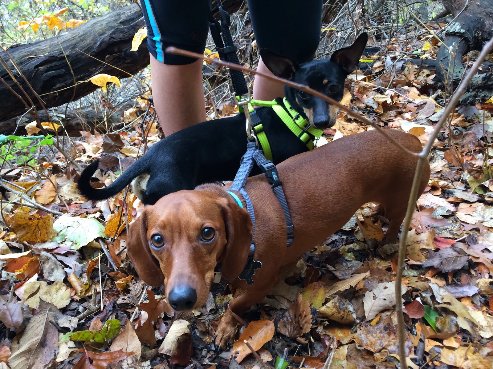
Terrianne had also responded to K2, and the three of us met in my driveway at 7:30 and left out to west Tulsa.

I started us out with an easy loop on the east side of the wilderness area, and I was a little disappointed to see that someone has been clearing land and making new roads. Some kind of development is forthcoming and I don't like it. But we got a little under three miles in before heading west to bigger hills and cooler trailz.

A lot of the trailz are actually double track (fancy-speak for two lane jeep roads) with some tight single track and some wide enough for 4-wheelers to maneuver through.


Terrianne and K2 wait for me--had to have a pee break. Shortly after that, we heard voices through the trees--kind of like something a fox would say if a fox could talk. And them lo and behold, Trail Jesus stood before us. TJ (aka John Nobles) was out with a few friends scoping out the course for a fat ass run called "The Worst Christmas Party Ever."
According to Cole Starkey, he and TJ
"have been spending the last few mornings on the trails. Every time we are out there my mind is blown, such variety and beauty throughout this otherwise unused trail system. It looks like we will be keeping our promise of using each trail only once to get to our 24. Will be going out Saturday and Sunday mornings as well if anyone wants to join in on the training and get a sneak-peek at this one-of-a-kind course."

The race supposedly finishes here--and if you are running and gunning it into the finish, you had better shut it down IMMEDIATELY after crossing the line. The first step past where Trail Jesus is standing is a big one.
The view from here is amazing. You can see forever (or all the way past Sand Springs, which is just like forever.)

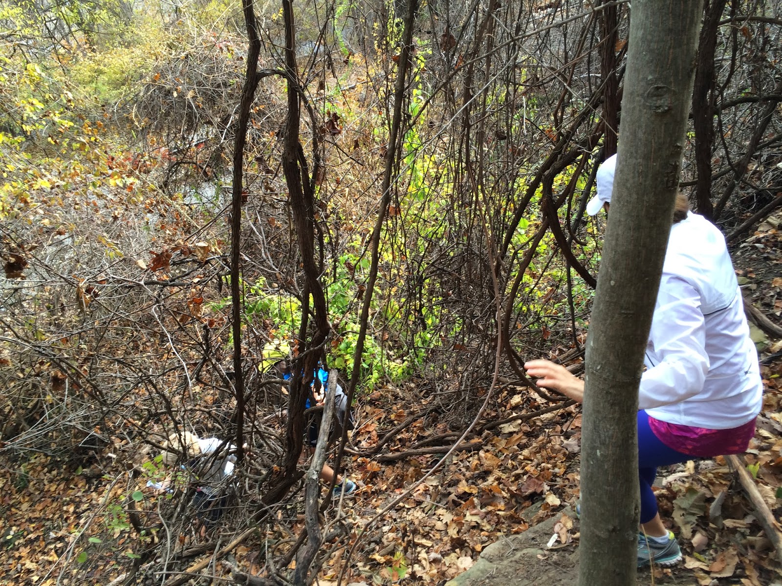
From there, we went to the bottom of the 60' bluffs through a narrow slot between huge rocks.

I maintain that the earthquake a couple of years back caused these rocks to move closer together. I had to definitely turn sideways to get through. I even had to take off my Camelback. It could also be because I ate much dessert Thursday and again on Friday. As seen above, K2 also had to turn sideways. I offered him my BodyGlide to help with his passage but he made it without it.

I always like to take a different way out--just HATE going back the same way I came. I thought there was another trail that led out, and took great efforts to find it. But I finally gave in and we backtracked a 1/4 mile back the way we came. Next, it was the maze. Up on the upper plateau, there are jeep roads that just go on and on and on. The tall grass is 8' tall, and there are scrub trees, and persimmon trees, and BRIERS that are 8-10' tall, and you cannot see anything other than the gradually turning rutted out dirt roads. There are two ways out of this maze, and several turns that make giant one-mile circles. I was up here once late in the afternoon, and it got dark on me. I had a headlamp, but made three one mile circles before I found a way out. I DID not want to go in even ONE circle today, and was oh so careful to make sure I was making the correct turns. In one place we came onto a ginormous mud puddle with a swampy mud bog on either side of the road and man-eating briers licking their chops hoping we'd even try coming anywhere other than right through the middle of the mud. We turned around and took a road that I was sure a big circle going nowhere but where we had already been. But luckily, we found the road kept bearing south and it eventually came out on the Powerline. Good news.

This huge plot of undeveloped land has in years past been a good place for people to dump the cars they'd stolen and stripped--often setting them afire. Once on the Powerline, we saw one of these cars, stripped, burnt, and flipped over. The odd thing was that there was a brand new tarp tied to the back of the truck, and it appeared that someone had been living under the truck with the tarp serving as their enclosure. The remains of a campfire, a can opener and a few empty cans seemed to bear this out. Here, K2 takes a load off, relaxing as the inhabitants before him did.


We dropped down through a narrow hallway to get to the trailz that led eastward. Terrianne is still all smiles. She was a good sport.

This Powerline trail is about three miles long, and has longer and steeper climbs that Turkey Mountains Powerline trail. It seems like it's much further, and just when you think you've got to the top of a long climb, there is another 100 feet to climb.


There was a few groans once we topped what we though was our last limb, and saw we still had this.

Rather than going down the last hill, I took us north through the woods and on top of a ridge. This eliminated one downhill and uphill. I am sure we had done enough ups and downs. Besides, this is a nice trail.

One last climb, and it was flat all the way back to the park. We ended up with 9.7 miles, and took over 3 hours to do it. We had a few stops to chat with TJ, pee stops, and hey--it was not a race.

I love running here, except after a rain. I may go back tomorrow too. We'll see how my knee and ankle feel in the morning.

When I got home, I had a call from my brother Fiver, who wanted me to show him a couple of abandoned home-sites on Turkey, as well as the moonshine camp. He is into the metal detector thing, and wanted to see what kind of gold/silver coins he could find. I was glad to do that, and Jake was glad to go with me.

We hit the moonshine camp first, where there is a geocache hidden and I have not been able to find it despite having looked several times. Fiver descended into the lower level of the ruins and scanned his gadget over the ground and it beeped immediately. He said it was a tight signal and there was something there. And wouldn't you know it? He found that geocache in a matter of seconds.
I have paid my dues looking for this one, and even though I did not have a pen, I am claiming a find. (I did go back later with a pen and signed my name. It's official. I now have found every geocache on Turkey Mountain.

Metal detecting was otherwise not-so-good here because of all the tin laying around and buried in the ground. So, we left for the other abandoned home-site. I thought we'd have better luck there. But, here, there was so much trash laying around that every hit was an old buried aluminum or tin can.

The following BitStrips are mine and Fiver's take on our adventure.

Fiver DID find two pennies--both buried about 8 inches deep. He also found an earring--probably silver and if it's a diamond, it's a big one.

Fiver did say that there was too much trash laying around and buried for it to be a "good" place to search.

Thursday, November 28, 2013

Happy eating

In considering my eating plans today, I hope to stick with my gluten-free/all organic diet. Having adhered firmly to this regiment for 11 days now and seeing a 7 lb weight loss, I don't want to undo my efforts all in one day. I DO love my fare (ample) share of turkey and all the trimmings, SOME of the casseroles, and PIE. I am sure many years on Thanksgiving day, I've consumed over 20,000 calories in one sitting. This got me to wondering what the world record for most calories consumed in one meal. Google listed the following story, taken from MAIL Online magazine.


A New Jersey woman who hopes to become the fattest woman in the world got 30,000 calories closer to her 1,000 lb goal with a festive feast that could have fed dozens of revelers. 644 lb Donna Simpson, sitting in a reinforced metal chair, chowed down on the world's biggest Thanksgiving dinner as she ate for two straight.
The single mother-of-two tucked into two 25 lb turkeys, two maple-glazed hams, 15 lbs of potatoes (10 lbs roast, 5 lbs mashed), five loaves of bread, five pounds of herb stuffing, four pints of gravy, four pints of cranberry dressing and an astonishing 20 lbs of vegetables.
Big business: Donna's high calorie diet costs her £500 a week - funded by a website she has set up for 'fat admirers' who pay to look at photos of her eating
Big business: Donna's high calorie diet costs her $800.00 a week - funded by a website she has set up for 'fat admirers' who pay to look at photos of her eating.

After polishing off her enormous main course, she still had room for dessert and ate a 'salad' made of marshmallow, cream cheese, whipped cream and cookies.
Donna's two children, Devin, 14, and Jacqueline, three, enjoyed a more modest feast.
The 5'2 Donna defended her $245.00 meal, saying: 'I eat as much as I want, whenever I want but at this time of year I really go all out.'
'Thanksgiving should give you carte blanche to do whatever you want.'
Donna, who insists she is healthy, told the Sunday Mirror: 'People who feel guilty about eating are hilarious.'
Donna hopes to one day be the Guinness World Record holder for fattest woman. She is already on the books as the world's fattest mum, having given birth to Jacqueline in 2007 when she weighed 38 stone
Donna hopes to one day be the Guinness World Record holder for fattest woman. She is already on the books as the world's fattest mum, having given birth to Jacqueline in 2007 when she weighed 532 lbs. She makes a living from being fat, getting paid to make public appearances and keeping a website where people can pay to watch her eat.

WHAT SHE ATE
2 portions of 25 lb oven roasted turkeys
2 portions of 15 lb maple glazed hams
10 lbs of roast potatoes
5 lbs of mashed potatoes
5 lbs of chopped carrots
5 lbs of sweetcorn
5 lbs of roasted butternut squash
5 parcels of house-baked bread
4 pints of cranberry relish
4 pints of home-made gravy
5 lbs of herb stuffing
1 tray of mixed green salad including salad dressing 

CALORIE TOTAL: 30,000

Already a Guinness world record holder for being the largest woman to ever give birth, Donna hopes to gain 350 lbs more and officially become the fattest woman in the world.
She got the Guinness World Record as  the world's fattest mother, when she gave birth in 2007 weighing 532 lbs.
She needed a team of 30 medics to deliver her daughter Jacqueline during a high-risk Cesarean birth.
Donna met Jacqueline's father Philippe on a dating site for plus-size people, even though he weighed only 140 lbs. He supported her 12,000-calorie a day diet and was a 'belly man' who loved her enormous shape.
Donna has always been plus sized.
When she  was 19 she met her first husband, who worked as a chef at a steak restaurant.
'He worked night shifts and would come home at 2 or 3  am and bring the leftovers with him,' she said.
She insists she's healthy even though she needs a scooter to get around and can barely walk. Her Christmas feast cost an astonishing £150
She insists she's healthy even though she needs a scooter to get around and can barely walk. Her Thanksgiving feast cost an astonishing $245.00.
'We'd stay up and eat huge piles of steak, mashed potatoes, and gravy with butter.I started gaining weight quickly and my husband liked it. He said I was sexier when I was bigger, and I felt happier too.'

When she was 27, Donna weighed 350 lbs, and fell pregnant with her eldest son, Devin. Her marriage ended soon after and she turned to food for comfort. By the age of 31, she weighed 602 lbs and decided to try and lose weight. She lost 70 lbs in six months and was due to have a gastric band operation. But just before she was due to go under the knife, her friend died during a similar operation. 'That was a sign for me,' she said. 'I decided it just wasn't worth it. I like being the way I am.'

Donna, then 532 lbs, came across a website which celebrated obese women. When she admitted her real size, Donna was flooded with emails from men. 'They sent me gifts through the post, like protein shakes to help me put on weight faster,' she said.
And she's unrepentant of her weight-gain goal, despite risking her own life in the process.
'I love eating and people love watching me eat,' she said. 'It makes people happy, and I'm not harming anyone.'

Tuesday, November 19, 2013

Scenes from a night run

I headed over to the parking lot at Turkey Mountain to run with the Tuesday Night Crawlers, rolling in at 6:25. The usual crowd at 6:30 either stayed home, or met earlier. We have talked about meeting at 6:00, and we should since it's good and dark by 5:45 anyway. I decided to go out anyway for three easy miles.


I ran the Snake Trail, one of the easier routes, hoping to maintain 15 minute miles +/-. While that seems slow, it IS on trailz and it IS at night. And I AM a slow ass zombie.

Running alone, I stopped a few times to get pictures. Last time I took night pix with my new iPhone, they were spectacular. Tonight, there were just too dark. So, I used Paint on my desktop to lighten them up. They weren't good enough to spend much time with Photoshop.

Looking westward, the sky was illuminated . I tweaked the tint and saturation just a tad for affect.


Awe--a zombie-selfie. Notice the appearance of sagging jowls under my chin. I tried to tighten that up digitally without success.


 On the Snake Trail, what was supposed to be a picture or mysterious trees against a splattering of night clouds revealed a ghost-horse-tree. Pretty eerie.

I finished my 3 miles (actually 3.03 miles) in 43:40, pausing RunKeeper while picture taking. This included four falls. Three three point landings, and one crash. I don't mind falling at all when it doesn't hurt. The last one hurt a little.

Sunday, November 17, 2013

There's gold in them thar hills

Just southwest of Tulsa lies a small red butte known as Turkey Mountain. In 1902 a small community called Red Fork thrived nearby. In September of that year Red Fork had a visitor, and when he left, he took over $700 in gold with him.

The old gentleman had come from the East and had given the ready-made excuse of "seeing the country" for being in town. He checked into the Field Hotel and employed the liveryman, Bill Barnett, to drive him to Turkey Mountain.

The stranger asked Bamett whether he had ever seen a rock up Turkey Mountain with a cross cut on it. Bamett recalled having seen such a rock and believed that he could take the stranger to it. After some hunting the two men found the stone. On its smooth surface had been carved a cross and the numbers 64, which, even though badly weathered, were still visible. The stranger pulled a compass and tape measure from his coat pocket and placed the compass on the rock. When he got his bearing, he gave one end of the tape to Bamett and told him to walk seventy feet south. From there Barnett was to walk east, turn south a few steps, and then drive a stake.

The stranger then sent Barnett to the buggy for a shovel and directed him to dig beneath the stake. After twenty or thirty minutes Barnett began to doubt whether the old man was "in his right mind." He stopped work and demanded to know what the old-timer was up to. The stranger told him to keep digging and assured him that he would be "amply rewarded." Barnett complied.

When Bamett had reached a depth of about two feet, his spade struck something solid. When he cleared away the dirt, he saw he had uncovered a rust-eaten kettle. Both men tried to lift the pot to the surface, but its weight proved too much for the decayed vessel. Its bottom crumbled, and out poured fistfuls of glittering gold coins.

"The old gentleman [the mysterious stranger] was in the service during the Civil War and was scouting in the Indian Territory," stated a report-er.6 "On one occasion he carried a large sum of money with him. It seems that he found himself at this time hard pressed by Pierce's army and buried the money. He claims to know of other buried treasure near here and says he will return and try to unearth more of the yellow metal in a few days."

The entire article including this excerpt can be found here.

Saturday, November 16, 2013

8 hikers celebrate a birthday exploring caves and finding petroglyphs

I was honored to lead a group of hikers on some trailz and particularly to the caves and petroglyphs at Turkey Mountain yesterday morning. We met at 11:00 and took a little 1.5 mile out-and-back and say some of the historic landmarks on Turkey--some that are centuries old. Pictured left to right--Good old TZ, Tim Baker, Mimi Tarrasch, Donna Bullock, Sheila Lauterbach (the birthday girl), Pricilla Boegh, Sue Parnell, and Julie Ladehoff. (Don't remember the doggies names either.)


We took the paved bike trail about halfway down the hill, and then cut over to the Lo Chi Trail. I love this trail--it has high bluffs to the west, the tallest trees on the mountain, many ups and downs, and is a nice not-so-technical single track that ends up with a mo-fo of a hill about a mile north. But for our purposes, we ran until the trail was 30 feet from the railroad tracks, and then dropped down for a little track work. This is the only way to the caves other than basically rappelling down from the Ho Chi.

 
The hike from the tracks to the shelf where the caves are requires an on-all-fours claw and scratch hanging onto trees and vines all the way. Our whole party scrambled right on up with no delays.

Even those with short legs made it up in quick fashion.

 
There's an order to how this area should be seen. I chose the Catacomb cave first. Most of our party climbed up to the entrance for a peak inside.


Picture swiped from Sheila Lauterbach

This cave is always dry. In a pinch, one could live here. It's a little short on modern utilities, but at least you'd have a roof over your head.


Picture swiped from Sheila Lauterbach

Just out the door from the Catacomb cave are a couple of old wooden ladders leading to another shelf which is actually above the Vulture Cave, aka Lo's Cave, aka Bad Dog Cave. These ladders have been here for 6-7 years and I question their safety.

Yep, I play with BitStrips on Facebook.


Picture swiped from Sheila Lauterbach

These are more of the inscriptions on the face of the bluffs. These are gradually wearing away. According to a couple of articles I have read, there are others carved in the rocks in nearby areas, but I have not found them.


Picture swiped from Sheila Lauterbach

Most of the gang climbed up and into the Vulture Cave, and I told them the story of the vulture, and also of the snakes that dropped onto a group of Halloween trekkers.

This is the petroglyph we came to see. This is Gwen, believed to be carved in the Pre-Columbian Era.

Climbing down is every bit as hard as climbing up, but we all made it with no mishaps. a mile and a half back to the parking lot, and the party of 7 continued their party at Hideaway Pizza. I think Sheila had a fun birthday.

Friday, November 15, 2013

Half and Half Preview

Sunday December 15, area runners have a unique opportunity to run not one, but two half marathons in Tulsa. The second annual Half & Half or Double Half will be held at Turkey Mountain. Runners have a choice of running 13.1 miles on trails, running 13.1 miles on the paved bike path on the west Arkansas River banks, or for the over-achievers--you can run BOTH!

Kathy Hoover, owner or RunnersWorld Tulsa, is known for "thinking outside the box" when it comes to putting on races.

She is Race Director of other fun events such as Race Into the New Year, Witch and Moan, and Run Tulsa Pink, and this race is possibly the only event of it's kind in the US.
This is the perfect race for someone wanting to compete on some non-technical (easy) trails. The trail course utilizes only the easiest routes on Turkey Mountain, avoiding (for the most part) the super rocky sections. Yes, there are a few hills--it IS Turkey Mountain after all, but you do not have to climb or descend the steep hill known as LipBuster (parallel to Elwood Avenue.)   It starts and finishes at the main parking lot at 68th and Elwood.

The road half marathon also begins and ends in the Turkey Mountain parking lot. This course runs downhill on the paved bike trail toward the river and follows this route all the way north to 11th Street and  you turnaround 2/3 of the way across the bridge. The return trip gives you your 13.1 miles.


Both races start at 9:00 am, and are ran simultaneously. With the Half Fanatics becoming as big as Marathon Maniacs, this is a chance for a double (two half marathons in a weekend, or in this case on the same day.)  Those wanting to run both, will run the trail course first. Finishing both will count as either two half marathon finishes, OR one marathon finish. Throw in the coolest medals I've ever seen, and this race is one you should not miss.
The urban wilderness of Turkey Mountain is beautiful all year round. In December, the leaves are mostly gone which opens up some fantastic vistas of the Arkansas River and downtown Tulsa.


Enjoy an aid station with  smorgasbord of goodies every 2.5 miles. Trail runners plow the cookies, PBJs, and chips, sometimes consuming more calories than they burn. A favorite concoction is an Oreo slathered with peanut butter, and topped with M&Ms. It's like rocket fuel.


The finishers medals are as unique as the race.
The left side is the medal for the trail race. The right is the road medal. Do both races and you'll get both. They fit together to form a yin and yang design. For a runner, you need this medal on your trophy shelf.
You can sign up online, at RunnersWorld, or at the race. More information can be found here. More information can be found here.

Thursday, November 14, 2013

The difference between killing time and wasting time

There IS a difference. Yesterday is a case in point. I have often referred to Geocaching as a fun way to waste time. I enjoy hunting for worthless treasures in the woods (and sometimes right in the midst of the overcrowded city) all to get to scrawl my "TZ" on a little notepad or a tightly rolled up strip of paper--and then clicking "found it" and putting in a meaningless comment like "TFTC", or "good hide". I sometimes say something like "easy peasy lemon squeezy", or "easy as pie", or "thanks, I needed that", or "so easy a caveman could find it". But in reality, it's a non-productive hobby; and when you could be doing something productive, it is a waste, albeit a fun waste, of time.

But yesterday, I had some downtime. I had to kill some time between a early afternoon completed job, and a 4:40 meeting in Broken Arrow to pick up some materials for a job the next day. Killing time is actually quite productive.  It feeds the mind, enhances the spirit, and makes for interesting blog posts.

I had not turned on my Geocaching app in a few months (ok, a few weeks), so I thought I'd try to hunt a few down. I nabbed a couple of "skirt lifters", and then headed east east east as far as 71st Street goes from Broken Arrow. Newt Graham Lock and Dam is part of the Verdigris Navigation Channel, and is a super good place for rednecks to dump trash. Another of my time wasting/killing hobbies is picture taking but I'll spare you the pictures of the dumped garbage. :-(  Just upstream is a very nice secluded campground called Bluff Landing. I have been here a couple of other times, and have never seen many campers, but there are always a few.


According to my GPS, there were several geocaches in the area. The first one was about 100 yards off road through a brier patch. I don't mind briers but those mini burrs that wad up in my arm hairs, socks, and shoe laces greatly discouraged me and since I had left my flame thrower at home, I skipped this one without much of a search.


The next one was also in the woods, but it seemed as if it were not more than 30 yards or so into a thicket. In fact, there was a faint trail that led almost right to it. You know how I love finding new trailz, but this one went no more than 50 yards, and even if it went further, there was not enough real estate for it to be very long at all.


Right in the crook of the largest tree in the area was the prize I sought. Just a log, a pencil, and a rock. I had nothing to trade for the rock, and didn't want the rock anyway, so I just TNLNSLTFTC (Took Nothing Left Nothing Signed Log Thanks For The Cache.)


I spent a few more minutes walking around, considering where the best campsite would be, wondering if this would be a good fishing spot, imagining Jake plowing into the water, and putting this camping trip in my short term bucket list.

And I goofed around with a few camera apps. This is with the Hipstamatic app again.

So, I successfully killed a couple of hours, found three Geocaches, took a dozen pictures, scoped out a camping spot, did a trail search, and came up with stuff for a blog post. Not a waste of time at all.

Tuesday on Turkey

Jake and I made a quick run on Turkey Tuesday morning. It was 28° and a bit breezy, but with the sun out and staying in the woods, it was not bad at all.
We parked at the Westside Y and headed out from there, pulling pink ribbons and yellow caution tape as we went. I have had super help this year marking and unmarking the Turkey and TATURs course. There was about a mile of the course that still needed to be pulled. I stopped to take a Lake Logan pic, using the Hipstamatic app on my iPhone.

 
The leaves are still fantastic. In another week, they'll be gone.

 
I'll be honest--Jake wasn't much help--just some good company.

Believe it or not--I make a wrong turn sometimes on the trail. I made a premature turn and noticed that I was not seeing any ribbons. Then I saw rocks on the trail that did not seem right, and realized my error. But I discovered this rock above. Standing upright, it seemed eerily like a homemade tombstone. Does anyone know the story of this rock?

We made our way to the end of the Spider (the Powerline trail where it overlooks the river and downtown Tulsa) and found where Lynna and crew had stopped their ribbon pulling, and we headed back on a different trail. Ended up with 2.5 miles. My running was nothing more than a shuffle. I'm still having knee issues.

You always see something new on the trail at Turkey. Besides the tombstone, someone lost their brain right on the trail. (I checked to see if I still had mine--I'm good.)