Showing posts with label spavinaw. Show all posts

Sunday, January 24, 2016

Spavinaw with friends

Some friends and I made the trip northeastward to the Spavinaw Wildlife Management Area (WMA) to run. I have been there a couple of times before, and remembered my way around pretty well, but had not seen all the roads/routes/trails there. I believe one could create a serpentine route that would be a good 50K in length without crossing the same trail twice. 


Johnna, Michelle, Jbob, and Lynna joined me and our awesome five-some headed out around 9:30 for a run of a yet-to-be-determined length. I had plotted out some possible route using MapMyRun, and we decided on an 8.3 mile loop with the option of adding an out-and-back. (Note the smiling faces.)

Having ran here before, I knew there were two ways to begin out run. One was to head straight west from the WMA office, which involved a beefy climb right out of the chute. I was here once in my Prius, and wanted to drive on the well maintained roads across the area to scope things out, and my Prius could not make it up the hill. (A Prius does not behave at all on off-road conditions, even when they're semi-well maintained gravel surfaces.) The other departing route takes you north on a road that is not on  all the available maps, but is a good route other than a few mud puddles--and  trail runners are ok with mud.


After a half mile, a gradual climb began. I had to make a pee stop (have not mastered the pee-on-the-run thing yet) and I fell behind--but engaged the shuffle mode and inched my way back to the group.

This climb had a couple of false summits--you the kind of hill that you see what you think is the top, and then around a bend the darn hill goes up, and at an even steeper grade. 

Despite this seemingly relentless ascent, I was not cussed at this point.


Mile two-ish. It was cloudy and and cold, but with no wind and our steady pace, we were warm and happy. West was thew direction and away we went.


Lynna was wearing a new pair of Hokas for the first time--breaking the "never wear new shoes on a long run" rule. I later was told she had wore that same shoe before--this was just a new pair of the same model. That's ok in my books.

Coming around the northern edge of the 8.3 mile loop, we finally got the pay off for all the climbing we had been doing. A nice 1.5 mile gradual descent made this my fastest mile--although it was not particularly speedy.  Michelle noticed a cave down in a holler that looked big enough to set up a couple of campsites in it. To get to it, and I wanted to, we would have had to butt-slide down a 75' drop, and then somehow climb back out--or go a half mile or so down the road we were on and follow a creek bed back up to the cave. We decided it might be a good thing to do on a later trip.

Since all of our group pics had the photographer out of the frame, we grouped in for a selfie shot. I gave up on trying to photoshop out the deranged look in my eyes. So there you have it!


Lynna decided to climb to the top of this knoll to see what there was to see. It was a mere 50 yards and not to steep. We made our way there, and the view was great. You could see for maybe a couple of miles down into a valley and back op another hill, and then beyond that. 

I took several pictures, but none could capture the view. This pano shot was the best of the bunch.

We reached this point--the intersection of Tower Road and SandPoint Ridge Road and had a brief conference. We had already tackled a good climb out of the Dog Hollow Valley, and had extended the possibility of the 8.3 mile loop. Should we go on?Should we find a way to loop back for a 9-sh mile loop? My adventurous side said no, and I talked the group into heading away from our cars and onto the SandPoint Ridge Road. I remembered this road from my last trip here, and it's beautiful, although I knew it would mean we'd have about 16 miles. My running buddies are good sports, but I do feel like I drug Michelle into going a bit further than she should have what with Switchbacks being just last Saturday.

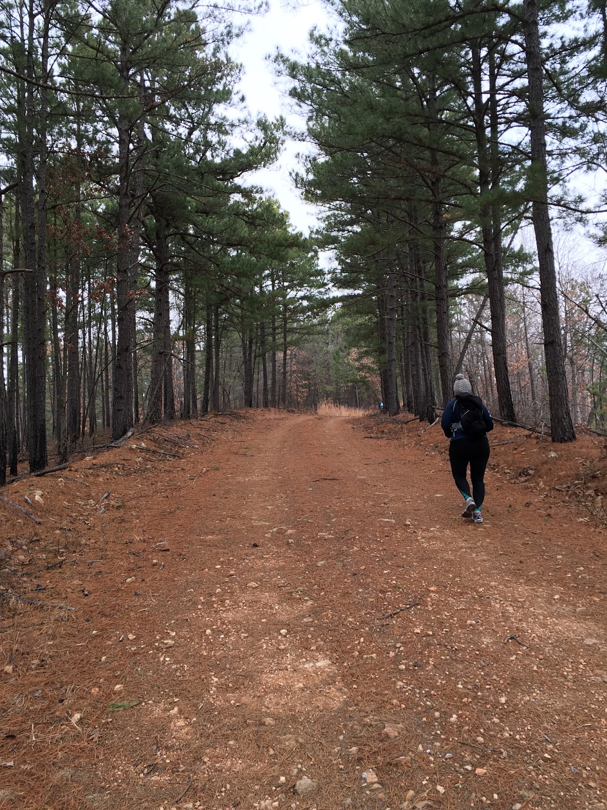
This was a gorgeous section of the run. Running under tall pines on a blanket of pine needles is my idea of heaven.  Jbob was awesome. He would run ahead, top a long hill, and then turn around and run back to whoever was furthest back (sometimes me, sometimes Michelle) and would jog with us and dole out encouragement. He ended up with seven more miles than I had, and who knows HOW many more feet of elevation?!?
Another pee stop for me and then I was chasing Michelle and Johnna. Lynna runs like a gazelle, and she would sometimes zigzag back with Jbob.

This loop goes through an a spot where there had been a fire years ago. Tall grass had taken over the bare area and it was beautiful. I am sure this IS a hunter's paradise.

Yes, there were a few flat sections.

Clicking off the miles. And thinking about food. We had been discussing feeding options from about noon on.

A little roller--up, down, up.

At another key intersection, this is the remains of an old homestead. I have also been here before and was confused as to the best way to go. 

There is a gravel creek bed that is marked as a foot traffic only route, but on any map I have seen, it's a dead end. It looked like from the maps we had with us that the route we needed was right here, but actually we had to go west and further away from where we parked to pick up a main route back.

So west we went. I posted a few pics on Facebook, and someone asked me WHAT was in the tree. I told them we were lost, and Jbob climbed a tree to see if he could get a bearing, and then slipped and fell. And the "thing" in the tree was his camelback. Of course it was lies all lies.

AHHH. Here is the road we were looking for. Cochran Prairie Road--a major route on the southern perimeter of the WMA. This road headed east--and up. Mostly up. 
 The sun had finally made an appearance, and blue skies were in full bloom. This also meant the frozen roads were turning to slickish mud in places--not to bad, but coming home with clean shoes was not gonna happen.

We then turned on Chicken Hollow Road, which I think gets it's name from the fact that it cuts off a big portion of the Cochran Prairie loop. 

More pine trees, more pine needles to run on. Johnna didn't let the hills phase her at all. Must be that this was still easier than Ouachita Switchbacks the week before. 

I announced that this was our last major climb. I was wrong. :-(

We did have a few flat miles once we hit Ground Dog Hollow Road. This runs along the bottom of a valley alongside a dry creek bed.


A little larger chunks of gravel, as I bet this was flash flooded during the recent heavy rains. I remembered this road heading east and descending right into the WMA headquarters--but what I did not remember was the 150' climb just before the descent. I'm sure I was cussed a little for this and suppose I deserved it.

 Final descent. Honest. I kept the shuffle thing going as it was steep enough to easily trash my quads. 
 We ended up with 15.6 miles. Here's our route. Compare this to the map below and you can see that getting at least a marathon distance would be possible without even crossing paths.


This is the best map I have found for the Spavinaw WMA. The black dotted lines are basically un-maintained roads, and during this time of the year, they'd be find. I bet some are impassable in the spring and summer.


I like this. I'd think about this graphic every time we climbed another hill. Sick, I know.

 A stop at the Dutch Pantry in Chouteau on the way home was awesome. Amish cooking, lots of pies and cakes, fried chicken, mashed potatoes, and scrumptious egg noodles. Worth the trip even with no running.

I plan on going somewhere out of town once a month, and I'd love to have a huge group of friends with me. We'll carpool and caravan there, run 15-25 miles, and then do the feeding frenzy thing. Fun.

Saturday, January 9, 2016

Report from a little run in 2012

I ran sort of an impromptu run today at Spavinaw WMA. I needed a good long run, and of course wanted to run it on trailz, and maybe someplace other than Turkey Mountain, although I love it here. A change of scenery is nice.
I posted this map on Facebook mainly because I wanted to do a screen capture for my phone, and talk of where this was and when I was going came up, and although I was not trying to take a gang of runners with me, some company was awesome. Scott Smaligo and Danielle Martin rode up with me and we took out running just after 9:00 am in 15° temps.
I had three layers of Icebreaker on my upper torso, and was plenty warm, sweated a little, but was never too warm. The sun was up and bright, and the skies were postcard blue, with only a hint of breeze a time or two during our run. I unzipped my jacket and removed my gloves to get the right body temps, and the cold was not a factor at all in my run. I'll call it perfect weather and good clothes.
I ran here last summer, and this seems like a super place to run long. It was today. I was a little concerned about there being deer hunters out, and later in our run, we did see quite a few pick-up trucks with dudes all camoed out. They all seemed friendly although one guy said (maybe kiddingly?) that he thought he had seen it all, referring to the oddity of seeing three runners out there in the middle of nowhere.
The course is mostly gravel roads, with a little dirt road here and there. The black lines on the map are good maintained forest service roads with places where the gravel was a bit loose and a bit large. I wore my Montrail AT Plus trail shoes, and they did me well, but the balls of my feet feel slightly bruised after 17.4 miles of these roads. Not complaining, just commenting.
It was DRY there, but early on, we did have one spot that was almost a mandatory water crossing. A good Kodak moment, and then we stepped around it.
I suspect there are around 20-22 miles of good roads like these, and several off-shoots which are not as well groomed. We took one such road/trail, and followed it for a mile thinking we would get a good view of Lake Spavinaw. My map showed it to be a dead end, but I still thought it might connect to another similar trail for a loop, but it did not. So, we had an out-and-back added which included a LOT of rustling through loose leaves. The game management folks just don't rake leaves.
There is another distinct feature to the roads and trailz here. The area includes Hills. We had 6 or 7 significant climbs on the run, and we talked about whether these were worse than Pumpkin Holler. I'd say close, but there are definitely more of them. Look at the course elevation profile down the page--or don't. I'll talk more about it when I get there.
I love running under the pines. It was nice to see something still green. I mentioned while taking pix that I loved doing so (and of course posting them.) I feel it's like throwing out bait--the next time we come up, we'll make a TOT run out of it, and pictures help sucker people in--hills or not.
This is hill number 4 or 5. We ran some of them, and would stop to walk the last little bit if they were real steep. I also use the take-picture excuse to catch a breather.
Danielle almost had Scott talked into walking across this fallen tree. It would have been about a 20 foot drop if he fell. No takers today.
At around mile 10, we ran through an area where a fire had cleared a large area of trees. It was still a beautiful area though. Not sure what these two were talking about--probably the fiscal cliff or something.
This is the start of a 1.5 mile gradual downhill. Fun.
Lots of little ups and downs to go with some of the longer climbs, but a lot of it was runable.
We finally came to an intersection where we accessed our pace/progress/time remaining, and decided to shorten our run. The big loop we had planned would have definitely been longer than 20 miles--maybe as much as 24, and Scott had a commitment at 3:00--so we lopped off the loop furthest west. This move dealt us a long steep hill which we discussed the possibility of there being a McDonald's or a QuikTrip at the top. I even thought we might see the pearly gates there, but we were all wrong.
With the map I had, I never felt lost. The roads marked were good roads, and we never made a wrong turn (while running anyway--I did miss a turn driving up here due to yapping and not paying attention.) Here, I KNEW we must be going the right way since there were TATUR PINK RIBBONS on the trees.
After running through a 2-3 mile stretch on the bottom of a beautiful valley, we had one more climb to get back to where our car was. This climb was followed by a very steep downhill that Danielle ran like a gazelle. Scott walked it, I jogged it, and Scott's walk was faster than my jog. My poor feet were sore, and I was to the point where I was liking the uphills more than the downhills.
This is the route we ran. The loop on the left would have been about twice the size if we had ran it. We might still be out there--ya never know.
And the elevation profile from my Garmin. I like looking at these, but they don't always tell the true story. I will not tell you this was a "relatively flat" course. But looking at this profile, you might think there were NO FLAT SECTIONS AT ALL. Well, there were. The first mile did not even seem hilly. We ran it all. Miles 2-4 were easily runable. Miles 9-11--another good fast section. And even though it looks like a killer climb, mile 14.5-15.5 was right down the bottom of a flat valley. It might have been a very gradual climb, but it was easy to motor even though we were all pretty tired.

This is a fun place to run. I wonder a little about whether we should have been there as I really don't want to interfere with a hunter and his prey. I'll check on the regulations before bringing a TOT group up. And when we do make the trip, y'all better come.