Showing posts with label Osage Hills State Park. Show all posts

Friday, July 22, 2016

Osage Hills write-up

Last Saturday the Osage Hills Relatively Flat Trail Marathon, Half Marathon, 10k, 5k went off almost flawlessly despite 96 degree heat and 107 heat indexes. We had a huge increase in runners fur in part to adding the 10k.
The half and full took off at 7:30. Most half era got the job done before the heat was out of hand. But the full had a tough battle. The full was pretty accurate but the half was s little over a mile long. The 10k also was more mileage than what was bargained for. The reason for the inaccuracies is last minute changes that had to be made to the course due to bad overgrowth, multiple fallen trees, and ticks.


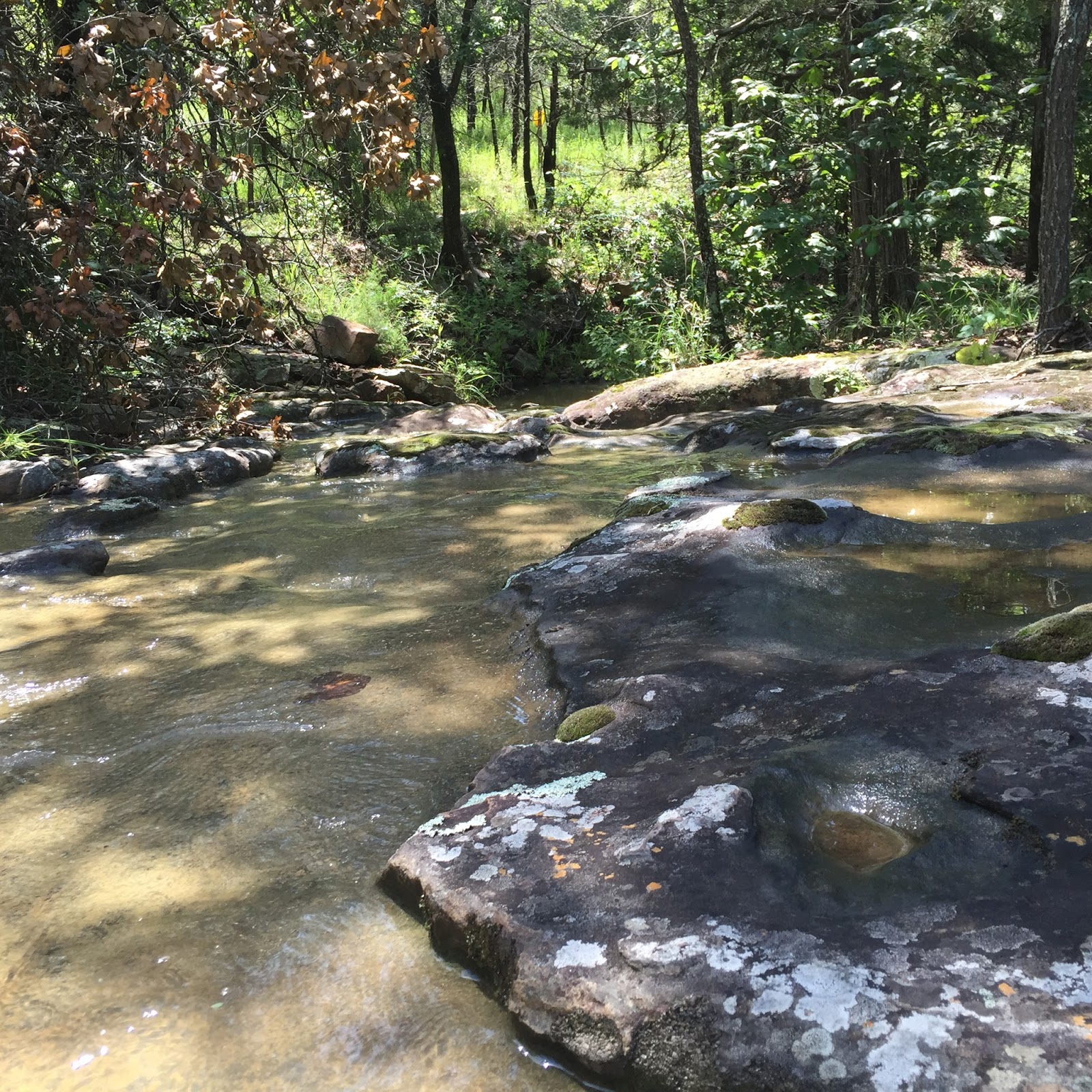
Like last year, runners sampled Sand Creek Falls. Ample opportunity was given for foot soaking, and a few did just that on their second and third loop.


After leaving the falls, a short climb led to the sign. Jodee and Candy were up to some shenanigans.


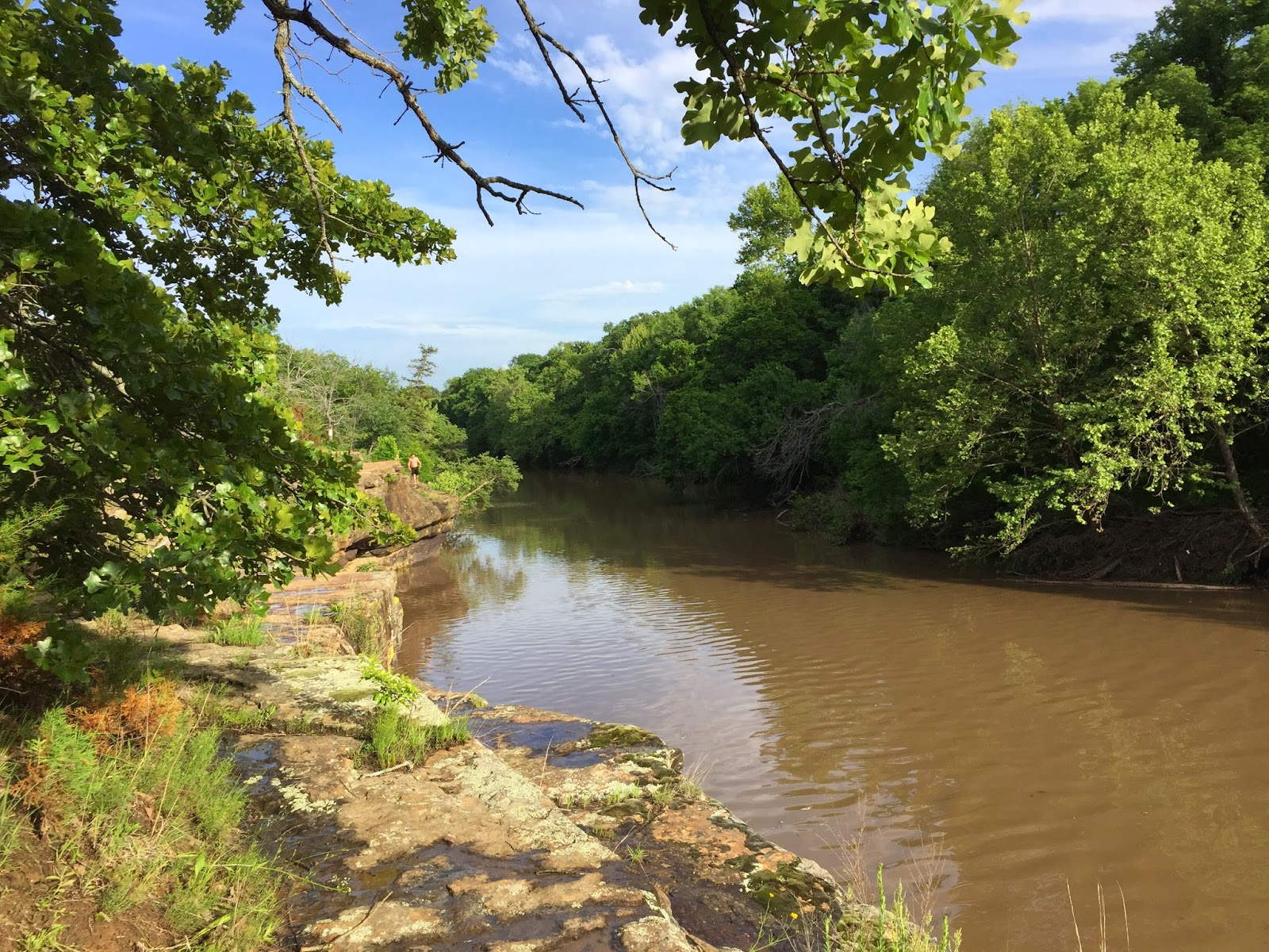
The course ran right at the top edge of these steep bluffs.


Good ground could be gained back on the Creek Trail. And this section was painfully flat.


A short rocky climb from the campground led to the LookOut Tower. Then a scamper through the woods dropped the runners off at the spider aid station manned by Shorty, RJ, and Johnna, and runners hit this stop three times per loop.


Most people liked the out and back over LookOut Lake Dam. It was just a half mile out and back, but is like to see a trail going around the lake. Not sure how to make this happen.


150 medals. 146 finishers. That worked out great. Congrats to all who ran. Special thanks to Matt Markel, Elisha Bell, and David West should helped me all day Saturday marking trails. And thanks to Jana, Lisa, And Krystal who worked the campground aid station. And to Shorty, Travis, and Johnna who worked the crazy intersection did station. And to Lynna and Dana who worked the start/finish. Thanks to Clint who did some course marshaling, and Chris's from Tatur Racing for doing a flawless job with the timing.


Click HERE for full results

Saturday, June 27, 2015

Relatively is the word

Last Sunday--June 21, was the first running of TATUR's Osage Hills Relatively Flat Trail Marathon / Half Marathon / Five Kilometer Race. I have ran Osage Hills for years, and a few months ago, Brian Hoover began kicking around the idea of having a trail race there. I jumped on board excited about the idea, and we put our heads together and launched what I hope evolves into one of the state's best trail runs.

Susan Melon Westmoreland designed the shirts and local screen printer Caveman Screen Printing produced what has become my current favorite tee.


This map is a fairly accurate detail of the trailz and the course we took.  We started near the swimming pool, went by the waterfalls, over to the Creek Loop and bluffs, then north on the Tower/Lake trail. We added an out and back across the dam of Lookout Lake, and then headed to the Mountain Bike Trailz. The original plan was to take the Red Trail clockwise,and then take the Blue Trail counter clockwise, and finally returning to the finish for one 13.1 mile loop.

I saw Friday that doing that had three problems. One: the course was almost a mile short. Two: It would require hauling an aid station or water drop a good half mile up hill on a trail that was technical in places. Three: The Blue trail had waist high grass and places and needed almost two miles of serious weed eating.

Brain and I spent most of Friday whacking weeds on the Red Trail, and late Friday afternoon, I saw first hand how bad the Blue Trail was. The solution was to run the Red Trail and we'd place an aid station near the end on an alternate trail head, and then run the Red Trail in reverse. We could get a table and tent with all the aid station stuff easily to this spot, it added the right amount of mileage to our course, and it eliminated the need to whack two miles of tall grass. Plus, it added a water crossing!

The course was marked with signs with arrows. I thought it was bombproof. But somehow a sign got turned pointing people down the blue trail. Adding confirmation that this "wrong way" was the right way--was two signs 100 yards up the blue trail that were part of the pre-marking. They were out of sight from the proper route, but once the wrong turn was made, it seemed to confirm that the Blue was the correct way. YIKES! 

So now, most of the half and full marathoners went 5.5 miles with no aid, came up short on their mileage, and waded through a couple miles of weeds.  There is no way after the fact to fix this. I placed every sign--I know exactly where every sign was placed-- and I am sick that the course markings were tampered with. So the way it will stand--the results will stay as they are. Anyone who truly feels they were shortchanged on mileage, or their placement in the race standings can contact me and I will grant them entry to one of our remaining trail races this year.

Now on to better things.


The half and full started at 7:30, and a rowdy crows took off thundering down a short strip of asphalt before spilling onto some soft dirt en-route to Sand Creek Falls.  

The 5K started at 8:00 and did the same loop--skipping the Creek Loop Trail, the northern half of the Tower/Lake Trail, and all of the mountain bike trailz.
Picture by Michelle Bates
It's easy to take a beautiful picture at Osage Hills. All you have to do is point and shoot. Sand Creek Falls is great for Kodak moments, feet soaking, picnicking, and swimming. 


Picture by Michelle Bates
We added a loop around the old ball fields. I've never seen signs of any baseball/softball/football here, but I always see deer. This time was no exception. Mike River, Travis Jennings, and I did triple weed eater duty and created a nice perimeter trail right at the edge/ I saw LOTS of non-race park visitors take out newly created trail.


Next up, the Sand Creek Bluffs, and then the Creek Trail. 


Picture by Michelle Bates
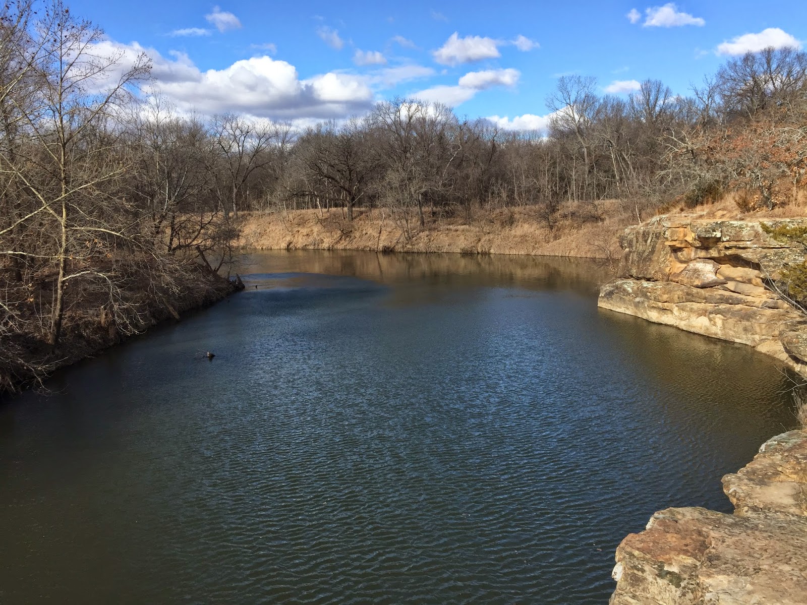
The bluffs are a popular place for dare-devil diving. This water here is always muddy. It seems much clearer downstream at the falls. You could not pay me enough to even jump off feet first.


The Creel Trail is a mile long loop that is TRULY relatively flat. No rocks, no roots. Horse flies--might have been a few.


Then after running through the campground the course climbed the Tower Trail. Ok ok, if someone insists--this was a hill. My buddy Brain Lamb said, and I quote, "Hey, wait a second. This place has a scenic overlook; what happened to the relatively flat?"


Picture by Arena Mueller
Here the group heads on to Lookout Lake.


You had to look for it, but this arch \bridge which was right before you crossed the road before the Devil's Intersection aid station.


Including an out and back across the Lookout Lake dam helped get the mileage to where we needed it for a two-loop marathon. I heard no complaints on this. I'd love to see trailz cut around the perimeter of the lake.


And a word to the aid station workers--Shorty and Luke Jennings along with Mishelle Hancock  manned Devil's Intersection, working  8 solid hours  Runners hit this aid station three times, and they had the responsibility of making sure everyone went the right way.


This is an old storehouse (looks more like a jail) by the mountain bike trail head. This was a welcome sight for those nearing the end of their loop.


The Red Trail had several water crossings like this. It started and finished with creek crossings that were shoe fillers. These rocky crossings were passable, but were also a great place to wet your face, hat, t-shirt. feet, or to just sit down in.

This crossing at the end of the Red Trail (a lot of people missed this one) had impressive bluffs downstream, and a small waterfall upstream.


Picture by Jessi Wiley
I didn't get many finish line photos. There was not an official race photographer. Jeremy, with great determination, finished his 26.2. This is just two weeks after having to drop from his first 100 miler due to a torn Achilles. It was a risky decision to run this race, but he took it easy and did fine.

Many thanks to all who helped. Mike Rives and Travis Jennings helped me assassinate weeds Saturday before the race. Travis killed his marathon, and then stayed to help load stuff up after the race. Brian Hoover, besides timing the race, helped me chop weeds Friday, and made the finishers medals.  Susan Melon Westmoreland handled the shirt production. Krystal Brown and Dalton Messenger manned the first aid station. Melissa Messenger distributed finishers medals after her stellar 5K finish. Michelle Bates jumped in and helped with prerace registration and packet pickup before her 5K. Jason and Sue Ann manned the unmanned aid station after their half finish, and stayed around and helped pack things up after the race. And last, but best, Dana aka TaturCaskes rounded up all the aid station food and supplies the few days before the race, cooked and served food and helped with the start/finish aid station, helped everywhere around the start/finish, then unpacked and cleaned up and put away everything at home after the race while I took a nap. 

I reserve the right to add people who helped that I am not remembering right now.


Finally--it has been brought to my attention that this course was ANYTHING but flat. Having a flat course is boring. Hills are good for your heart. Look at the above elevation profile. It LOOKS healthy. It looks like a pulse line, does it not? If it were flat--well flat lining is very bad. Relatively flat is your friend.

Now the course elevation below has a vague resemblance to the one above. However, it IS hilly. You might say it's a Monster of a course. I would not call it flat.

Sunday, May 17, 2015

Pictures of the Osage Hills State Park Relatively Flat Trail Marathon / Half Marathon / 5K

It's Sunday June 21--just a month away. The start/Finish will be at Shelter #2--close to the swimming pool. (I believe it will be open too!) 


From here, we'll run south and pick up the Falls Trail. There will be about a half mile for those speedsters to get their lead and us middle packers can spread out and get ready for an enjoyable day on the trails. Bring your cameras.


Right now, there is so much water flowing down Sand Creek that the falls look more like rapids, but in a month, it will look more like this picture from last summer.


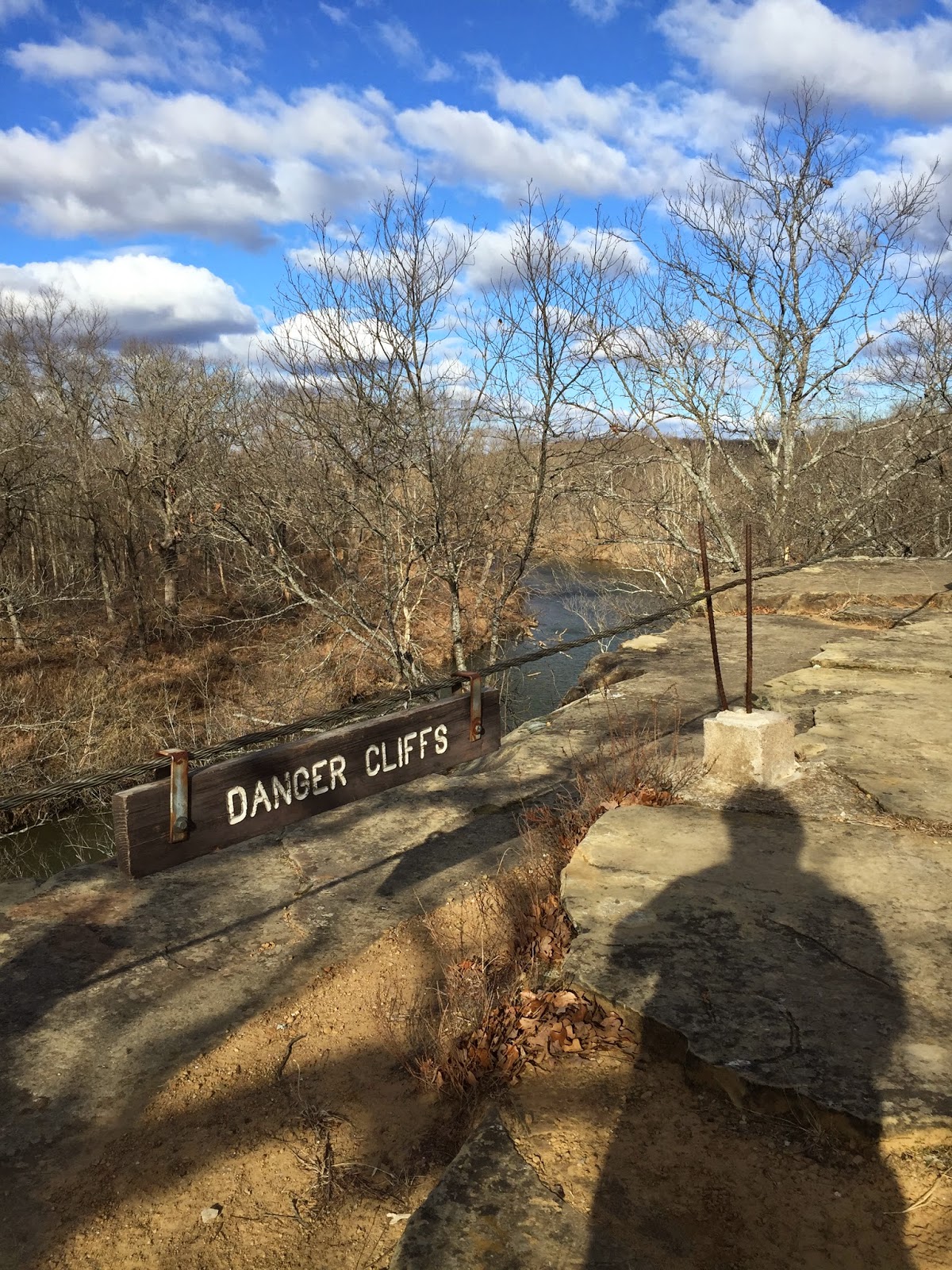
After visiting the falls, there is a short climb to get on top of some high bluffs. We almost called the race Danger Cliffs, Just stay away from the edge. ;-)


After a little jaunt through the woods, we pop out on this service road, and we'll do an out-and-back and loop around a grassy field where I've always seen deer---sometimes LOTS of deer.


Then we take the Creek Loop, and make a quick detour to check out another bluff view.


Today there were a couple of crazies jumping off the bluffs. Take a picture, but don't take a dive.


The creek trail is pancake flat, no rocks, and shaded. You can pick up the pace here.


There was a water crossing on the Creek Loop, but it will most likely be dry by race day.

We'll run through the camp ground and hit an aid station before taking on the tower loop. Here, you'll have a good quarter mile climb. It's not too steep, but it is rocky.


You'll pass the overlook--it's called a tower, but it's really a rock platform with a rock wall. You do not have to climb up the stairs, but it's a good picture-op if you wanna. (Or hey--I may change my mind by race day and make everyone go there!)


The Tower/Lake Trail gives you a good look at Lookout Lake, and there is a split in the trail that leads you down to the lake--but you stay on top of the hill.


Winding back around to the south, you'll see this old bridge that's almost 100 years old. 


Crossing the main road, you'll come to this old storehouse building that looks like it once was a jail. Your second aid station will be here.


This is also where you'll tackle the mountain bike trails. These trails are winding and twisting. There may be a water crossing or two if we keep getting rain. You'll run the big red loop first clockwise, and then the inner blue loop counter clockwise, and then hit the jailhouse aid station again.


This will be one of the probable water crossings. Worst case scenario (or best case if you like water crossings) the water will be shin deep. Or it may be dry.


Besides deer, you'll see possum, armadillo, raccoon, eagles, owls, and squirrels.


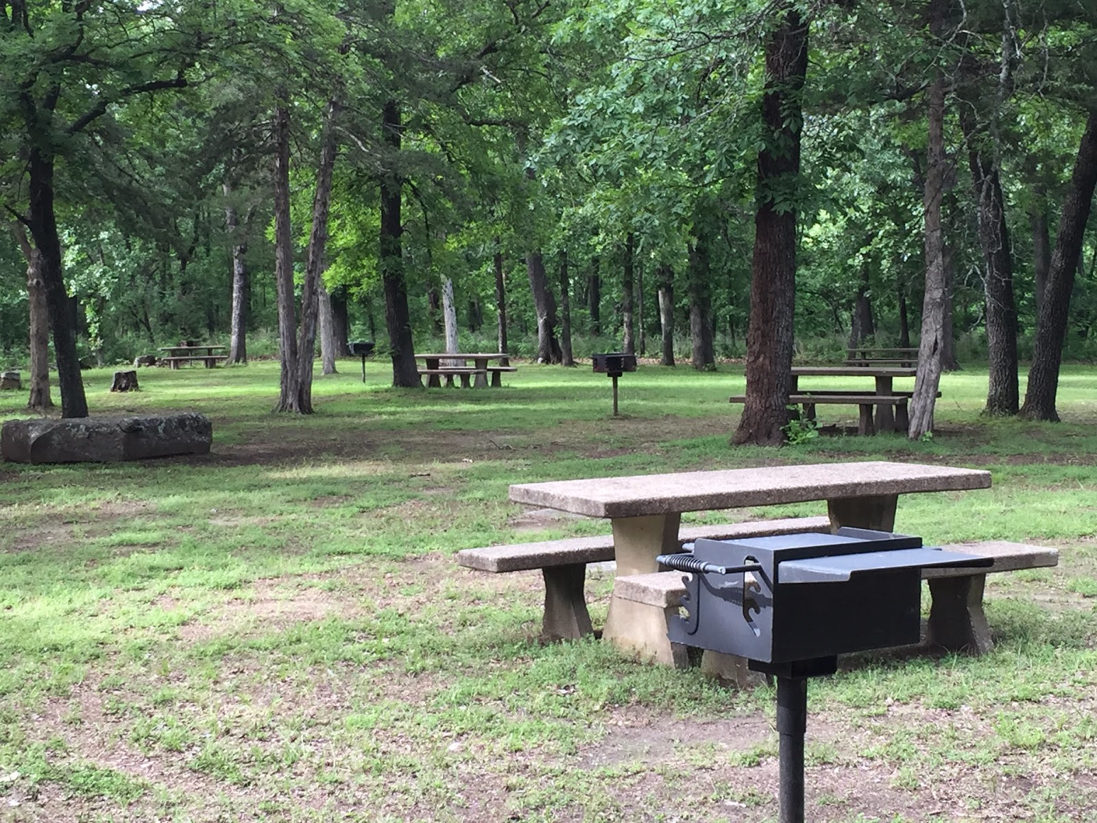
There's lots of picnic tables near the start/finish. No camping at this spot, but there are plenty of tent sites for $12/night and RV camping for $20/night--first come first served.


There are 8 cabins that can be reserved for $90-105/night. They look nice and are air conditioned.


They'd probably make you a good deal on this one. Just hope it doesn't rain.


I took a trail map and highlighted in pink the race course. It is close to a half marathon distance and the full will run the loop twice. I have not decided if the second loop will be ran in reverse or not. The 5K will be a smaller loop, obviously--probably turning east at the tower. Rest assured the course will be well marked with signs with arrows, pink ribbons, and orange cones.

There will be awesome awards for the top 3 male and female in each distance. There will be age group awards as well.


And get your cabin rented before they're gone.

OSAGE HILLS STATE PARK
2131 OSAGE HILLS STATE PARK ROAD
PAWHUSKA, OK 74056
PHONE: 918-336-4141
TOLL FREE 1-800-654-8240
(between Bartlesville and Pawhuska on HWY 60)


Sunday, January 25, 2015

Osage Hills Run

This morning, a few of the Sunday morning Turkey Mt group caravanned to Osage Hills State Park to run some new (new to most of us) trailz. It's 67 miles one way, and to some--driving 114 miles to run 5 miles seems silly, but the trailz here are so amazing it's well worth the drive.

We had a few runners meet us there--peeps who live in Bartlesville or Dewey. Krystal Brown and Don Gillam were two.
We started out in the main campground which had an unlocked bathroom (and hot showers, which we wold not need this day.)


Our first half mile was a styeady climb to the highest point in the park. There's a "observation tower" there, and we gathered around and observed. It sometimes is an amazing view from here.

It's also a good place for a group picture. Our dog runner was JD, who did a good job of herding us around the loop.


I led for most of the way, and had a good run (which means a good pace for me.)


When I steped off the trail to take pictures, I would bring up the rear until the group reached an intersection or a WOW place.


Lookout lake is one such WOW place. A trail actually leads right down to the shore, but we bypassed that turn choosing to stay on the main loop.


I have always found this old bridge fascinating. It was built close to 100 years ago, and will no doubt last another 200 years.


Get a good look at this shelter. This will be race headquarters for a new trail marathon/half marathon/5K to be held on June 21. 
It will be called the DANGER CLIFFS TRAIL MARATHON / HALF MARATHON / 5K. 
Online registration will be open soon.


Here is the beautiful Sand Creek Falls. There are actually people who visit the park and have not made the trek down to see the falls. They are amazing!


Philip and Coleen cross a natural dam to see a gurgling channel of rapids.


We climbed up and out of the falls area to the top of some bluffs. it was here that the idea for calling the upcoming trail race here "Danger Cliffs Trail Marathon.". I LOVE THE NAME!! Clyde Cole gets free entry to the race for suggesting such as perfect name.


And along the cliffs we did go. There are a couple of different places where you can run right on the edge--and over the edge if you are not careful.


From here, it's a good 60 feet down to to the water.
My biggest fear here is not the height, not of falling, not of hitting my head on rocks below, but of drowning because I would sink right to the bottom of the river. I guess if I hit my head on the way down, I might not even have to deal with drowning.


The race will run by each of these areas, but we will stay a safe distance from the edge, won't we? (Nod your head yes!)


After that, we ran a loop trail that is rockless and pancake flat (which is actually flatter than relatively flat, in case you were wondering.) Philip and Coleen asked for a shortcut back to the car and I sent them the wrong way--so we all ended up with 5.1-5.15 miles depending on whose GPS watch you wanted to believe.

No trail running trip to Bartlesville is complete without a trip to Murphy's Steakhouse. Normally, I would order breakfast food, but Murphy's is famous for their Hot Hamburgers.

What you have here is a generous hamburger patty on Texas toast, and then a pound of hand cut fries and brown gravy poured over the whole mess. It is off the charts!! I have done some calculations, and depending on the gravy, it has 1300-1600 calories. I ran 5 miles with a few inclines, and might have burned 600 calories, so I stand to gain a pound today. Lucky me.


And Lucky Me is right. I made a happy plate and was happy to make that plate happy. I know some people are vegetarians or vegan, and some people just won't eat grease and starch. But they are the ones missing out. If no one had been watching, I would have licked the plate.