sharing a dinner out and movie popcorn
a short night of sleep
mix in morning long run
breakfast with friends
some grass mowing
a beer or two and a nap
another run--this one at night
no sleep--til after breakfast
a shower and a nap--barely in that order
a medium bike ride
a shared 5-dollar foot long
a movie out--nope, a movie at home--nope--fall asleep in the easy chair
somehow end up in bed, and sleep the third morning away
grilled hamburgers with family
a night much later than it should be
damn Tuesday sure seems like Monday
I bailed on going to HNH 100 today, and instead spent the day with my sweetie running some of the incredible trailz above the Illinois River NE of Tahlequah. The pictures from the previous post are a sampling of why I cannot stay away!!There are rocky sections, steep uphills, and downhills, and a lot of nice runnable pine needle covered single track. Zombie food!! (Well, TZ food at least!)
Aside from a bit of commenting on the steepness of the grade and the abundance of sharp flint rocks, Taturcakes seemed to enjoy the day.
The edge of the bluffs where I was Thursday--Dana was a bit iffy about getting too close to the edge, but she did venture close enough to take this picture.
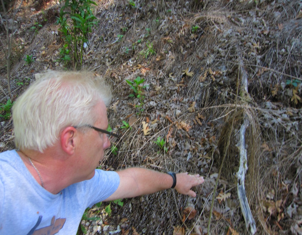
Thanks to a handy ledge on a craggy rock and a prop-up by my camera case, and the use of a 10 second timer, this pic was made possible. Hurrying to beat the 10 seconds to the edge of the cliff--maybe not the best idea.
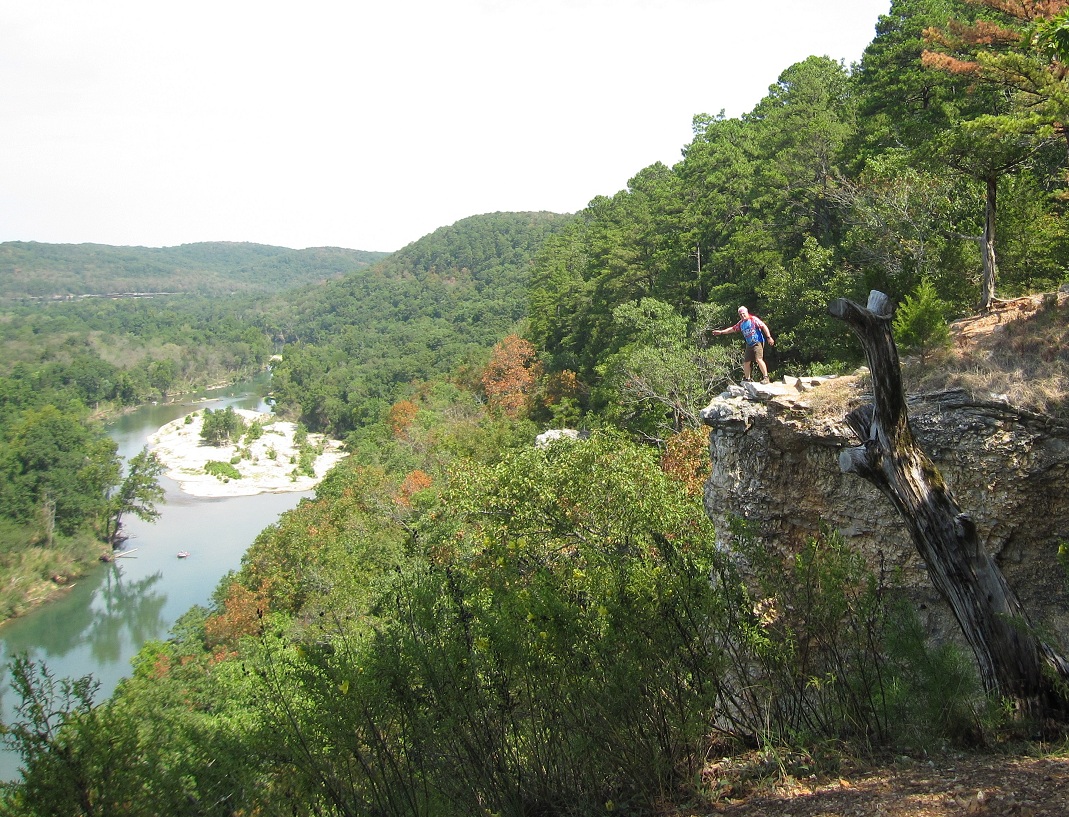
I photographed this cliff Thursday, and today, Dana waited while I scampered up over and down to it. I gotta say, with my bifocals, and creeping to the edge, it was a bit eerie. I stayed a safe distance away from the very edge, although I had planned on leaning out over it.
I met a runner out on the trailz today, who knew a little about trail running, and had heard of Pumpkin Holler and knew a few folks I know. Small world. I asked him if he knew of any other trail spurs up here, and he said that really all that was really here was a 2 mile straight-thru to Sparrow Hawk Village (Where I went Thursday) and a couple of apron trailz near the trail head. Dang! I wish there were 7-8 miles more!!
So Dana and I continued on in a direction that seemed north, but was really more east. The way the river winds around makes me lose all direction. (I did have my Garmin, and should have checked my heading!)We made it to the end, and the trail actually dumps out into someone's driveway. We used that driveway, their street, and followed the gravel and paved roads back to our car.
We were treated to over a mile of nice shaded downhills with a few switchbacks. But all too soon, we ran out of downhills and shade. The sun was up and cooking, and with the temperatures at 93ish, we slowed our pace and did a little more walking. We both had two water bottles, and were drinking liberally.
Dana stops for a break in some shade. We were setting no land-speed records this day. It was somewhere along here that food started sounding SOOO good. We decided Sam and Ellas Pizza in Tahlequah would hit the spot!!
Two miles of trail, and 4.4 miles of road, and we were done. We gave thought to running some of the Pumpkin Holler course, but instead just drove a couple of sections.
One last pic for the trail. Legs tired, bellies full. It was a great day.
Yesterday, I drove to the Pumpkin Holler Hunnerd course to do a little mapping--particularly to find good driving routes for the crew to get to the crew-access stations. The plan was to find a way for the crew vehicles to get there without driving on the course. Google maps is a great tool, but sometimes it shows roads that are really not there. Farmer Brown drives his John Deere across a field, and that swatch of beat down grass shows up on Google maps as a road. That can get you in trouble!!I drove the course, and found a perfect way in to the Hard-Up Ahead station, that is all paved!! YAY!! I then followed the course toward the Nickel Preserve headquarters and I hoped to meet with those folks to tell them about our event. Upon getting there, the doors to the building were unlocked, and I let myself in. "Anybody here?" Hellooooo?" I guess they aren't afraid of anyone coming in and carting the place away. Maybe I'll get to see them next time.With a little luck, and a little rain, we may still have great leaves come October. It's been dry, but I am thinking maybe this area has got as few more drops of precip than we have in Tulsa. The Illinois River did not look at all to be down.Bambi looked well hydrated and nourished as well. No telling what kind of wildlife you'll see here.
I found a couple of convenience stores that are not all nighters, but will still help crew out as they restock with ice and snacks for their runners come race day. I am working on maps with the crew routes included.
Once this recon work was done, I headed off to check out some trailz I have heard about at Sparrow Hawk. I posted a few months back about going here, but that was all a bogus figment of my twisted imagination--or was it a reality in an alternate timeline??? Hmmm....?
On the way there, I spotted this power-line easement, and I have teased Brian about running this. I pulled the Prius over, and today was the day!!!! This is one of those tasks that cannot be accurately documented on film. Pictures just do not do this justice. This appeared to be at least a 200 foot climb in less than .2 of a mile. It seemed more "up" than "out", which would make it more than a 45 grade.Truly, at times, you could reach out and touch where your next footfall needed to be!! It was slow going, taking a good 20 minutes to make it to the top. Again, I could not get a camera angle that accurately depicted what this route actually was. It did pick up enough sweat beads to make my story a bit more believable.You would think that coming back down would be easier, but I did not want to finish on a roll, and it took 17 minutes coming down, sliding and dislodging much scree on the way. Bonus--I upped my tick count by THREE doing this climb!! After this diversion, I headed for Sparrow Hawk.
I found the trailz pretty quickly, but still I went to the camp headquarters to ask for directions (and maybe a map.) No map, but I did visit with a gal who had few teeth than I had ticks. She pointed me back in the right direction and I embarked on a run of an unknown distance.(The trailz started out with some nice climbing, and I was impressed. The trail twisted around a ridge and hugged the mountain and it seemed like I might be in for hours of fun. I had a half bottle of Gatorade, and had forgot my Garmin. I also realized I did not have a light, which I did have in my car--back at the trail head. But I kept going on. Soon, the narrow single track turned into a wider trail, and it seemed to make a beeline toward something--I was not sure what. After a half mile, the trail ran right against a huge drop-off--and a series of bluffs. The views were amazing. I found a break in the trees and managed this pic. I continued on, and the trail climbed. Soon, I hit a very rocky section and it seemed that after this climb, I was out of trail. I did see where it seemed to head down down down--right to the edge. So, I followed. Just before going over the edge, I was treated to a panoramic view that is why postcards were invented. As far as you could see, there was river, and distant horizons. WOW!!! Looking upstream--to the north.... and looking downstream to the south. I am guessing I was 200 feet above the river. I gave thought to throwing a rock out to see if I could hit the water, but the uneven footing seemed a bvit of a risk, so the rock idea was shelved. I headed out, but not before taking a picture of his handsomeness, and making a video. Excuse the shakiness of the film. The wind was a bit strong, and I was on uneven ground. But the panorama is sweet. From there, I headed on north. the trail was good, but there was nothing to top the bluffs. Doh!!! I ended up running almost right into a house with a fenced yard. A map check later shows me that had I went down the driveway of this house, I would be on a nice road that switchbacks down the side of a huge hill and leads right back to where the trail head is. Sounds like the makings of a good loop.
Thursday, August 25, 2011
Last weeks trail was on the north shore of Lake Sahoma just north and west of Sapulpa.There is a faint jeep road and a fainter hint of a trail that heads around the lake. It would be a great place for a whole buncha nice single track, but right now, other than the little bit that you see here, it's mostly bush-whacking.
I am betting this is a bit more recognizable. A whole bunch peeps will be seeing this in October.Probably gave it away, huh?
This is gonna be quick. Last weekend was a good one for training. There was not a hint of speed, but the time-on-feet was sufficient for ultra-training. Early Saturday morning, I ran with my buddy Pat and the RW gang. I got in 15 miles, and headed home for a nap. The nap never happened though, and when Midnight rolled around, a motley crew of runners assembled at our house for a night run.
We ran from our house down the west side of the river and back up the east side using Quik Trips for our aid stations. The QT at 15th and Denver was swarmed by 50+/- cars of rowdy sorts who had hip-hop music with the bass so loud it vibrated my brain. We were stupid enough to sit at a table in front of the store and the scenario rapicly deterioated as one group got into a shouting match (complete with a series of colorful hyphenated 4-letter words) and it seemed like we were only seconds away from seeing knives or guns. Dummy me and K2, along with BeeSting Bob were on the wrong side of the parking lot while the rest of our running team exited to the south. Fortunately, we were able to walk right past the mayhem, and escape unnoticed.This was taken in front of Tulsa Ballet. Sorry for the fuzzy shot. I was running without my glasses, and obviously did not have the Canbon set on the proper setting for a clear pic. All but BeeSting ran 23+ miles, and spent the whole night doing it.
Dana went home, showered, and crashed. I went to Turkey Mountain to run a short jaunt with the TOTs.The numbers on Sunday mornings have dwindled slightly, and I musyt have smelled really bad because only six runners joined me. We got three miles in, and I was surprised I still had some shuffle in me. I went out for another couple of miles afterward, and took a few pics. I am in a picture-taking slump right now. Most of it is due to not swinging the bat. No snaps means no pics. 20 snaps means a few good ones at least. This one was the best of the crop from Sunday morning.Happy running, everyone.
Driving past Page Belcher Golf Course. Would rather be golfing....Glad to have blue sky--helps my psyche.
This old tractor is buried alongside 33rd W Ave amongst wild weeds. I am sure the weeds have no idea that this machine could annihilate them--I would like to see that happen. I think one could find new things along the way every day, and to ponder the story behind that old building, that twisted tree, the crook in the road for no reason....life puts the pages of a book in our path if we'd just slow down to read them.
In an effort to make my blog a little more magazine-like, I thought I'd do a weekly post with a theme. I have a blogger-friends who do Watery Wednesdays, and Friday Funnies --where they'll post pictures in a theme. I thought I'd do a semi-weekly post about new undiscovered trailz. Well, of course they aren't totally undiscovered if they are THERE, but they most likely are new to most of my friends. And really--some of them are probably better left untrodden, if my tick counter is any indication! I also thought I'd encourage readers to guess the location. Most will be around here--NE Oklahoma, although it's my party and I make the rules. I might throw an out-of-state pic in. To be fair, I'll make the rule tat is has to be a picture I have taken as opposed to a googled picture of a New Zealand or New Guineau trail. Fair enough?Well, this pic is in fact in Oklahoma--maybe within 15 miles of Turkey Mountain. Any guessers?
I am really getting behind in my blogging. Last post was a pictureless post, and was quickly whipped out and I pulled a muscle in my arm patting myself on the back. Last Friday, I joined some friends as we attempted 36 miles on the Creek Turnpike Trail.It was Susan's birthday run, and she was turning 36. The plan was an 8:00 pm start, running past Mingo and taking the Liberty Trail to 71st, hitting Braums, and then returning to the Creek/Liberty Trail to NSU and back. We had stashed a few coolers with ice, water, and Gatorade, and 7 brave kindred spirits took out into the night.The Creek Trail has a fair amount of hills--none that will kill you, but enough to be called "hill training". We ran, walked when we had to, and enjoyed each other's company all the way.The spur on the Mingo Trail was new ground for most of us. The trail meanders through SouthCrest and TCC before hitting a mile long new section along 169. This trail is a nice run but probably a better ride. After rehydrating at Braums (mostly ice and water--I wanted a shake but thought better of it) we headed back. Right after crossing 71st St, a carload of drunken adolescents yelled at us threatening to kick our asses. Kathy yelled back, and they sped off. Funny stuff--ya had to be there.Under the tall bridges of 169, a wealth of surrealistic picture opportunities await me--on a trip during a rising or setting sun.
As warm and humid as it was at the start, we were cold and shivering through Broken Arrow. 40-50 mph winds made the light rain sting our faces. Roman, Kathy, Caroline, and Dennis had turned back and were in the warmth of their cars when the rain hit. Roman and Kathy met us in BA and they picked up Mitch and Caroline. Caroline then crewed Susan and I, and those runners more sane visited IHOP. I ditched my camera with Mitch since it is not waterproof, so that was the end of the pix.
Susan had ran only about 30 miles in the past year!! Doing 36 seemed unlikely, but she was feeling good and we kept running a 11:ish pace and walked only the steeper hills. Our overall pace never really dropped off much. Take away our stops at the aid stops, and we'da had a 11:00 average. Caroline waited for us up the trail every 3 miles or so, and the miles clicked away. We rolled into the QT parking lot some 8:45 later, and had to add about .2 miles to make an even 36.
Birthday girl was all smiles. I bet she has an ultra in her near future. (Pumpkin Holler maybe??)
In the last 11 days, I have been on a tear. I've biked or ran (some days both) every day, and have had 127.3 biking miles and 105.5 running miles. My training for my fall races is doing ok--by the numbers anyway. I think I have solved my blister issues, thanks to Eric Steele and his foot concoction. The potential chafing probs are always kept at bay with Dana's SacSoSoft. Swallowing enough SaltSticks and organic sea salt keeps my tummy happy and keeps cramps away. I plan on using Do-Wacka-Do as my last long run in preparation for FLATROCK, where I hope to come away with my KNIGHTHOOD, a permanent cloth bib and lifetime entry to more of the ROCK, and enough umption to do well at Arkansas Traveller the next week. I want a sub 8:00 at Do-Wacka, 7:52 or faster at FlatRock, and a sub 24 at AT100. (I can dream, can't I?)
I still have not made hill work a part of my weekly routine, and I could still work some of that in. The other numbers (the lbs) have only slightly declined. I am down about 8, and would like another 15 to GO AWAY!!!!