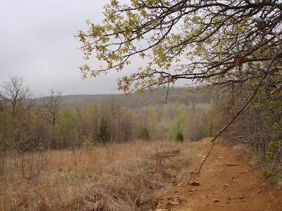
As promised on the TATUR chatroom, and on my FaceBook account, here are my pictures of the trails on Zombie Hill. It was a gray drizzly day, and I was going slow, having already ran once early this morning, and fed my face liberally with donuts, bagels, Tom's awesome protein bars, and some PBM&M Oreos, then a huge bacon egg and cheese quesadilla.
 Not having ran these trails before, (I actually did explore here some 4 or 5 years ago when I was a brand new trail runner and had long since forgotten about this area) I was not sure how long I would be gone or how far I was going. On a lazy Saturday, that was OK. I had my Garmin to tell the tail of the distance ran, and in a pinch I could use the breadcrumbs feature to find my way out.
 First creek crossing. I managed to keep my feet dry all day, despite the light rain that fell later in the day. Keeping my shoes clean turned out to be another story though.
 A few mud holes along the way. Actually, there were some small ponds across the trail in a few places.
 On Turkey Mountain, there are a few small caves if you know where to find them. On Zombie Hill, there are probably a few as well. It will take some time to find all the cool stuff out there.
 A scary looking tree. I'll shoot several pics of this tree I am sure. Jack with the shading and tint. Might find my way back here at night sometime.
 Similar rock outcroppings like nearby Chandler Park.
 I need a few more weeks at Weight Watchers to be able to navigate this passage.
 Somebody's old campfire site.
 Another sign of some sort of civilization. I am pretty sure the roof leaks a little.
 Out of the rock wall area, and onto the high country. There are several miles of old jeep roads like this, with heavy briars lining either side. Good place to stay on the trail.
 Ok, I lied. I did head back over to the bluffs. This was probably the tallest face I have seen along this ridge. I am guessing it is a good 60 feet down.
 If you know your Tulsa geography, you should be able to figure out about where I am.
 From the overlook, I headed south. A nice single track trail led me right down to a creek botom, and the trail disappeared. So I followed the creek, and evidently someone who was cutting the trail had the same idea. After a quarter mile, and with a little bush whacking, I found where they resumed cutting the trail.
 Gotta few battle scars. Of course any true trail runner likes a bit of blood as proof of a good run.
 There are a lot of good climbs along the way. This short section was straight up, and slick.
 A powerline runs about 3 miles east and west, and there are fair jeep roads under the lines all the way. These were the muddiest traails/roads in the area, and the stickiest clay/mud you can imagine.
 OK, I need some help here. My smoking days are long over, and as I recall, this looks a lot like what some of my former acquaintances used to smoke. Is it is? Or is it ain't?

 Lots of animal tracks. Of course there were a lot of deer tracks. Some stah I am thinking might be raccoon or possum. Several tracks like this, that look canine, but dogs usually step left feet/right feet....at least my labs do. These tracks seemed to indicate more of a gallop. A Google search seemed to indicate they were coyote, which is no surprise.
 These were more interesting. After seeing these, I paid real close attention for some similar, bigger cat tracks. But these bobcat tracks were the only feline ones to be seen. Both above paw prints are ones I shot....the Google drawing is a cut and paste.
 Of course, there were a lot of zombie tracks out there today, and I brought a lot of mud home with me.
 It was a gray drizzly day, and I was going slow, having already ran once early this morning, and fed my face liberally with donuts, bagels, Tom's awesome protein bars, and some PBM&M Oreos, then a huge bacon egg and cheese quesadilla.
 Not having ran these trails before, (I actually did explore here some 4 or 5 years ago when I was a brand new trail runner and had long since forgotten about this area) I was not sure how long I would be gone or how far I was going. On a lazy Saturday, that was OK. I had my Garmin to tell the tail of the distance ran, and in a pinch I could use the breadcrumbs feature to find my way out.
 First creek crossing. I managed to keep my feet dry all day, despite the light rain that fell later in the day. Keeping my shoes clean turned out to be another story though.
 A few mud holes along the way. Actually, there were some small ponds across the trail in a few places.
 On Turkey Mountain, there are a few small caves if you know where to find them. On Zombie Hill, there are probably a few as well. It will take some time to find all the cool stuff out there.
 A scary looking tree. I'll shoot several pics of this tree I am sure. Jack with the shading and tint. Might find my way back here at night sometime.
 Similar rock outcroppings like nearby Chandler Park.
 I need a few more weeks at Weight Watchers to be able to navigate this passage.
 Somebody's old campfire site.
 Another sign of some sort of civilization. I am pretty sure the roof leaks a little.
 Out of the rock wall area, and onto the high country. There are several miles of old jeep roads like this, with heavy briars lining either side. Good place to stay on the trail.
 Ok, I lied. I did head back over to the bluffs. This was probably the tallest face I have seen along this ridge. I am guessing it is a good 60 feet down.
 If you know your Tulsa geography, you should be able to figure out about where I am.
 From the overlook, I headed south. A nice single track trail led me right down to a creek botom, and the trail disappeared. So I followed the creek, and evidently someone who was cutting the trail had the same idea. After a quarter mile, and with a little bush whacking, I found where they resumed cutting the trail.
 Gotta few battle scars. Of course any true trail runner likes a bit of blood as proof of a good run.
 There are a lot of good climbs along the way. This short section was straight up, and slick.
 A powerline runs about 3 miles east and west, and there are fair jeep roads under the lines all the way. These were the muddiest traails/roads in the area, and the stickiest clay/mud you can imagine.
 OK, I need some help here. My smoking days are long over, and as I recall, this looks a lot like what some of my former acquaintances used to smoke. Is it is? Or is it ain't?
 Lots of animal tracks. Of course there were a lot of deer tracks. Some stah I am thinking might be raccoon or possum. Several tracks like this, that look canine, but dogs usually step left feet/right feet....at least my labs do. These tracks seemed to indicate more of a gallop. A Google search seemed to indicate they were coyote, which is no surprise.
 These were more interesting. After seeing these, I paid real close attention for some similar, bigger cat tracks. But these bobcat tracks were the only feline ones to be seen. Both above paw prints are ones I shot....the Google drawing is a cut and paste.
 Of course, there were a lot of zombie tracks out there today, and I brought a lot of mud home with me.
No comments:
Post a Comment