
I am a map nerd. No genius, I just like maps. I have a DeLorme Atlas and Gazetteer by the commode for quality bathroom reading. I have found awesome places to run by studying the many pages of this stapled conglomeration of lines and dots, with the Pumpkin Holler course being a good example.


I know a little about Mooser Creek, having published pictures of the clear pools of water running under 60' bluffs on the northern edge of Turkey Mountain. I know Mooser Creek runs under the Pepsi Bridge, and on the northern edge of the YMCA property. I also understand that the creek originates a few miles to the west, but I had never seen it any further west than from the YMCA. So, with Jake by my side, we went exploring. Jake takes his second swim in Mooser Creek via the Westside Y.

I could not find a trail at all from the YMCA, but we followed the creek westward as it hugged the I-44 service road. Jake again sampled the water, which is crystal clear. On a blue skied 70° day, even I gave thought to taking a dip.

Crossing under HWY 75, we followed the creek--no trailz--but we hugged the edge of the creek and crossed several times on rocks. I managed to keep my feet dry, while Jake managed to get his whole coat wet. This house, which had it's own bridge over the creek, looked to be 100 years old. We passed by unnoticed, but I would love to get to know these folks.
By now, I realized the map was just "proposed" trailz, but I wanted to see more.

(Click on the above picture to enlarge it. Should be readable.)
In 2006, the City of Tulsa published future plans for southwest Tulsa, which included a lot of trail work. Part of the plan was for a trail system along Mooser Creek. I am in favor of this, although it looksd like they are doing a paved trail on the north bank and just a trail on the south bank. Would we really need both? Just the dirt trail would be fine by me. :-)

We kept going, bushwhacking at times, and I knew I wanted to eventually head south to Riverfield or Lubell Park. Climbing a decent hill through lots of green briers did a number on my morale, arms, and legs. AT the top, we ran into a neighborhood, and I did not feel like waltzing through someones back yard. We headed back north and west, and eventually hit the creek again. I thought it was Mooser, but looking at some online maps, it was another creek. Can't find the name of it..
Just around the bend, the banks were high and the water was deep, so we scrambled through the tall grass and briers. We followed what looked like a deer trail, but obviousl these deer were not at all bothered by wicked thorns.

Finally we were able to get back to the creek and cross. Heading south, we ran into another fence, but a huge tree had fallen on it making crossing over easy. A few more yards of bush whacking (a machete would have been nice) and we popped out on a wide trail. :-)

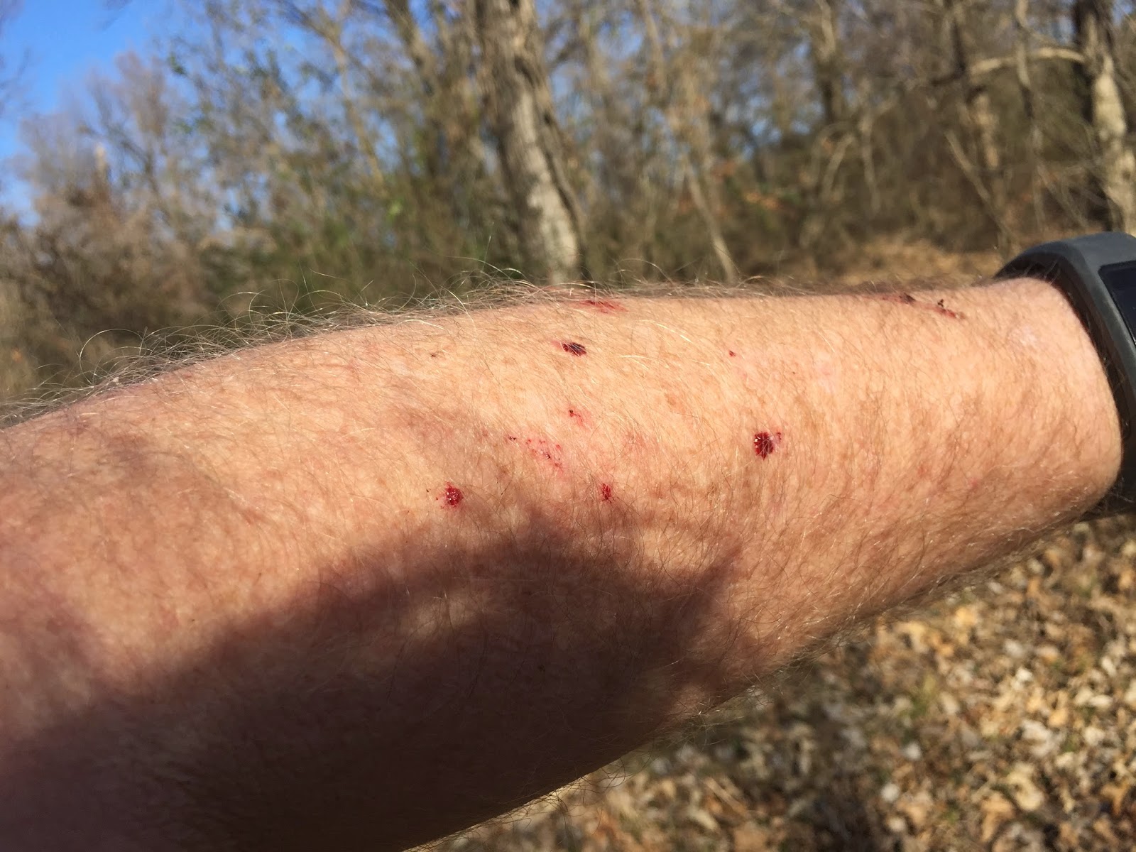
Battle scars for the day: a dozen puncture wounds to the arms, and slashed legs. These are a trail runners badge of honor.

First and foremost--this stream should be protected. Construction uphill (outlet mall, etc) will pollute this clear free flowing water.
I wonder if these plans for a trail system along Mooser Creek have been scrapped? This is such a beautiful place, and would be a huge asset to our city. I'd love to see these built!!
Dear Ken,
ReplyDeleteThere used to be a trail on the south side of Mooser Creek on Turkey Mountain. It was east of Hwy 75. It fell into the creek in the late 1990's. I used to run on it in 1997-98.
Earl