With it being Dana's weekend to work, I had the whole day Sunday to myself. It was hot--like 99 degrees with heat indexes at 115. I needed a long run--20 miles or so, but that was very unlikely. I decided to head north to Bartlesville and then west toward Pawhuska to the Osage Hills State Park. The last time I was there, I had found some new trails that a mountain bike club had cut, that went on and on and were quite runnable. It was time to check them out!
I avoided actually driving through the town of Bartlesville (for no particular reason) and took the country roads to the state park. What a treat to have such a beautiful day to run in. If only it were about 62 degrees!
 When I go back, I will come this way, even though it probably means more driving time. Of course the next time I venture this way, this bridge will be gone. A new one was being built 1/4 mile up-river.
Upon reaching OHSP, I cruised the park and camping area looking for any undiscovered trail heads and actually found one that I may try next time up. Then I stopped by the park office to see if they charged for day parking. (Did not wanna get a ticket like I did at McMurtry last March.) I asked if they had any idea how far the new bike trails went, and they opened a desk drawer and handed me a MAP!! This looked like it had just enough details to get me around the course, but as much as I was sweating, I knew the paper would disintegrate in a few minutes in my pocket. So I snapped a pic and used that for reference. Worked great.
 I debated parking by this small lake, thinking that it might be safer than parking by the trail head since it was semi-secluded. But no one was parked here either and if someone broke into my car, then what the H??? I have insurance. Turns out at the end of the run, nothing was disturbed, and I am guessing that would not be an issue here anyway. Plus, campers were few and there was no foot or bike traffic anywhere in the park. It was just so dang HOT!
So I ventured out. I had my camera, my iPhone, a couple of packs of shot blocks, some electrolytes, and my 22 oz water bottle. The plan was to run the outer loop, and then the inner loop--all in one swoop, or make a trip back to the car to refill with water between loops if need be. Looked doable. I had my first of many water crossings not a half mile into the run, but no prob keeping feet dry in this one! Most of these trails were narrow single track, not a lot of rocks, but a few. Not too many hills, but a few. Mountain bikers like trails that are rideable, and these were runable too.
 A short downhill rocky section.
 Every now and then, the trail popped out into a meadow. Here, the flora tended to edge in on the trail. A little more bike and runner traffic would help this, as would a weed eater.
 TZ sported a sea green bandana--drenched with sweat early on. I had it down over my ears to keep them from sun-burning. An added benefit from this was that the horse flies could not buzz my ears. I think it really confused them, but one followed me for most of the day.
 Look!! Some nice green carpet to run on!! There was about a hundred yards of moss covering the trail. Very cool!
 There are quite a few rock formations to run through and around. There are also a couple of small caves in the state park which I visited last time here--last year on Thanksgiving day. Click here for some pictures from that run.
It was somewhere just after that where I came to an intersection. I knew I would be hitting it somewhere along here and knew I needed to turn left. Turning right would take me into the inner loop, but I needed to get back to the car to refill my water bottle. However, while the map showed there was a fork here, and left was the correct turn, the directions the trail went did not quite match up with the map. Hmmm. I followed and thought maybe the trail would switch back and head back towards the trail head. That never happened. It seemed that I was heading south and west instead of north and west. After a half mile, I decided that this was not the correct turn, but the trail was good, and it seemed to be following the bluffs above Sand Creek and I thought it must hook back up with the river near the western part of the camp grounds. A mile later, this was seeming less likely. I only had a small swallow of water left, and I had long since quit running but was hiking at a moderate pace to conserve energy and to keep my sweating down somewhat. I debated filling my bottle here, but chose not to. I have drank from streams before and would probably do so here, if the water were running, but this was standing water. I have watched Monsters Inside Me, and I don''t want to do the parasite thing!
I had just about decided to turn around, when I saw this cabin off to my left. It was a welcome site, but the strange thing is, why was it on the LEFT when the campground and cabins at the state park were in the right? Maybe I was confused?? My thoughts were--knock on the door and ask for water. Or maybe they had a hydrant. No one home, and it looked to be vacant. There were no hydrants either. So, I followed the road that led to the cabin thinking there would be others. I came to a big stone picnic shelter and there were no hydrants there either. I started toward a camping area, and YAY!! I found a hydrant!! I doused down, filled my bottle and drank til I sloshed. (Hope it was potable water!)
I was ready to be back at my car, so I decided to follow the roads although I was not completely sure where I was. Eventually I saw a sign--Camp McClintock. I had noticed a sign out on the highway on the way in this morning. Following the roads meant at least 6 miles to get back to my car!! But at least I was heading there on a route that would get me there! Problem is, there was no shade. and no wind. The scenery was great though. The more I thought about it, the more I decided maybe I had made another wrong decision. 6 miles of walking and 22 ozs of water seemed like a bad equation. Eventually, I crossed a cattle guard and I pondered the idea of following the fence line back towards the start park area. The trails I had ran on tracked right by a boundary barbed wire fence a couple of times, and I was sure following this fence would take me home.
 I am sure I picked up most of my chiggers through here. But, this fence, after going down a small canyon and back up, did indeed take me to the trail, ironically very near where I had made the wrong turn. This time, I went the other way and very soon after that I came to the intersection noted on the map where the REAL left turn was. AHHHH. Now it all made sense.
 Last climb, and I was back at my car!! I slugged down a couple of cold bottles of water and a cold Gatorade, read some email, and pondered what to do from there. The plan was to go out for another loop. I decided against that. Plan B was to go for a swim/soak in the Sand Creek rapids.
 I headed over, and my camera was acting up, and I decided to just head towards home. I wwas HUNGRY anyway. The above pic is from the last time I was here. My camera is kind of hit-and-miss. (I do have a birthday coming up!!)
Next time I come, I'll know where to go and where not to turn, or if I choose to head toward Camp McClintock, it would be a nice out-and-back. Next time, I think I'll bring Dana and camp (in a cabin!) Or maybe a group of friends could invade the trails here. Twould be great fun!
I avoided actually driving through the town of Bartlesville (for no particular reason) and took the country roads to the state park.
 What a treat to have such a beautiful day to run in. If only it were about 62 degrees!
 When I go back, I will come this way, even though it probably means more driving time. Of course the next time I venture this way, this bridge will be gone. A new one was being built 1/4 mile up-river.
Upon reaching OHSP, I cruised the park and camping area looking for any undiscovered trail heads and actually found one that I may try next time up. Then I stopped by the park office to see if they charged for day parking. (Did not wanna get a ticket like I did at McMurtry last March.) I asked if they had any idea how far the new bike trails went, and they opened a desk drawer and handed me a MAP!!
 This looked like it had just enough details to get me around the course, but as much as I was sweating, I knew the paper would disintegrate in a few minutes in my pocket. So I snapped a pic and used that for reference. Worked great.
 I debated parking by this small lake, thinking that it might be safer than parking by the trail head since it was semi-secluded. But no one was parked here either and if someone broke into my car, then what the H??? I have insurance. Turns out at the end of the run, nothing was disturbed, and I am guessing that would not be an issue here anyway. Plus, campers were few and there was no foot or bike traffic anywhere in the park. It was just so dang HOT!
So I ventured out. I had my camera, my iPhone, a couple of packs of shot blocks, some electrolytes, and my 22 oz water bottle. The plan was to run the outer loop, and then the inner loop--all in one swoop, or make a trip back to the car to refill with water between loops if need be. Looked doable. I had my first of many water crossings not a half mile into the run, but no prob keeping feet dry in this one!
 Most of these trails were narrow single track, not a lot of rocks, but a few. Not too many hills, but a few. Mountain bikers like trails that are rideable, and these were runable too.
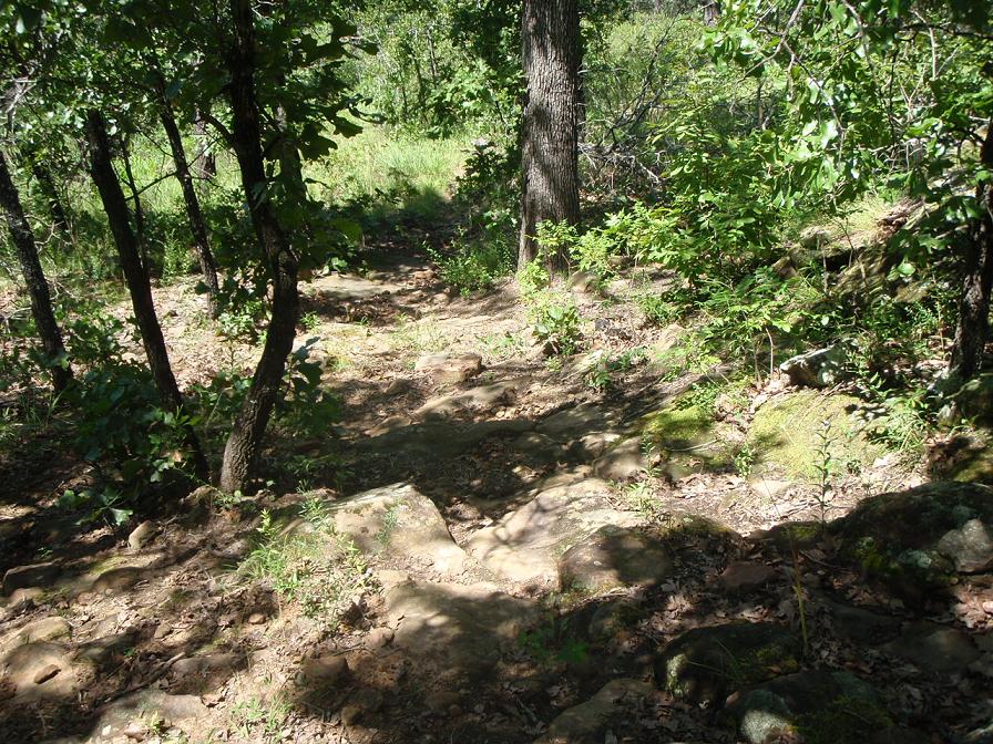 A short downhill rocky section.
 Every now and then, the trail popped out into a meadow. Here, the flora tended to edge in on the trail. A little more bike and runner traffic would help this, as would a weed eater.
 TZ sported a sea green bandana--drenched with sweat early on. I had it down over my ears to keep them from sun-burning. An added benefit from this was that the horse flies could not buzz my ears. I think it really confused them, but one followed me for most of the day.
 Look!! Some nice green carpet to run on!! There was about a hundred yards of moss covering the trail. Very cool!
 There are quite a few rock formations to run through and around. There are also a couple of small caves in the state park which I visited last time here--last year on Thanksgiving day. Click here for some pictures from that run.
It was somewhere just after that where I came to an intersection. I knew I would be hitting it somewhere along here and knew I needed to turn left. Turning right would take me into the inner loop, but I needed to get back to the car to refill my water bottle. However, while the map showed there was a fork here, and left was the correct turn, the directions the trail went did not quite match up with the map. Hmmm. I followed and thought maybe the trail would switch back and head back towards the trail head. That never happened. It seemed that I was heading south and west instead of north and west. After a half mile, I decided that this was not the correct turn, but the trail was good, and it seemed to be following the bluffs above Sand Creek and I thought it must hook back up with the river near the western part of the camp grounds. A mile later, this was seeming less likely. I only had a small swallow of water left, and I had long since quit running but was hiking at a moderate pace to conserve energy and to keep my sweating down somewhat.
 I debated filling my bottle here, but chose not to. I have drank from streams before and would probably do so here, if the water were running, but this was standing water. I have watched Monsters Inside Me, and I don''t want to do the parasite thing!
I had just about decided to turn around, when I saw this cabin off to my left.
 It was a welcome site, but the strange thing is, why was it on the LEFT when the campground and cabins at the state park were in the right? Maybe I was confused?? My thoughts were--knock on the door and ask for water. Or maybe they had a hydrant. No one home, and it looked to be vacant. There were no hydrants either. So, I followed the road that led to the cabin thinking there would be others. I came to a big stone picnic shelter and there were no hydrants there either. I started toward a camping area, and YAY!! I found a hydrant!! I doused down, filled my bottle and drank til I sloshed. (Hope it was potable water!)
I was ready to be back at my car, so I decided to follow the roads although I was not completely sure where I was. Eventually I saw a sign--Camp McClintock. I had noticed a sign out on the highway on the way in this morning. Following the roads meant at least 6 miles to get back to my car!! But at least I was heading there on a route that would get me there! Problem is, there was no shade. and no wind. The scenery was great though.
 The more I thought about it, the more I decided maybe I had made another wrong decision. 6 miles of walking and 22 ozs of water seemed like a bad equation. Eventually, I crossed a cattle guard and I pondered the idea of following the fence line back towards the start park area. The trails I had ran on tracked right by a boundary barbed wire fence a couple of times, and I was sure following this fence would take me home.
 I am sure I picked up most of my chiggers through here. But, this fence, after going down a small canyon and back up, did indeed take me to the trail, ironically very near where I had made the wrong turn. This time, I went the other way and very soon after that I came to the intersection noted on the map where the REAL left turn was. AHHHH. Now it all made sense.
 Last climb, and I was back at my car!! I slugged down a couple of cold bottles of water and a cold Gatorade, read some email, and pondered what to do from there. The plan was to go out for another loop. I decided against that. Plan B was to go for a swim/soak in the Sand Creek rapids.
 I headed over, and my camera was acting up, and I decided to just head towards home. I wwas HUNGRY anyway. The above pic is from the last time I was here. My camera is kind of hit-and-miss. (I do have a birthday coming up!!)
Next time I come, I'll know where to go and where not to turn, or if I choose to head toward Camp McClintock, it would be a nice out-and-back. Next time, I think I'll bring Dana and camp (in a cabin!) Or maybe a group of friends could invade the trails here. Twould be great fun!
No comments:
Post a Comment