The TOTs trail trips have turned into the highlight of my month--running-wise anyway. We have picked out some awesome trails within 100 miles of Tulsa to run. This time around, we went to Greenleaf State Park near Braggs Ok. It was a smaller group this time around. It was in the low 40s, after we have had a week of nice warmish spring temps. It was misty with gray skies, and there was a bit of a north wind. But we had guests--a group of runners from the Muskogee Running Club, and a Tahlequah group--the RiverHawks joined us. On the left, Joel Everett--RD of Do-Wacka-Do, and the new Muskogee 15K-- guided us to the best parking area nearest to the trailhead. In the orange, Rebel listens to Joel's instructions while K-State fan Cherry and shivering Teresa ponder what they have gotten themselves into. Russell knows. Miles and miles of great trail running.
 From our parking area, we had to run around a quarter mile down an old paved road to the single-track trail. Michelle, in the Post Oak shirt, led the way--at least for the Hello Kitty Runners.
 Greenleaf Lake--one of Oklahoma's most beautiful. This small lake has great fishing, cabins, deer and turkey hunting (which closes the trails for running :-( ) and has a reputation for being the tick capitol of Oklahoma. With the cold temps though, I was sure we would not have problems with he 8-legged critters this day.
 One of the landmarks for this trail is the swinging bridge. There will be a day that this bridge needs repair, and I hope they restore it instead of building a boring concrete structure. This is part of the charm of this trail, and runners, hikers, and bikers alike look forward to seeing it for the second time late in their journey. This series of trails-- a 6-7 mile loop, with another loop beyond that is rugged with lots of hills, and the bridge on the way out is a welcome sight.
 There may be a weight limit, but lucky for me, it held up a bulging zombie. Running the bridge is tricky, and when two people are running on the bridge at once, it is a trip!
 After the fast group and the Hello Kitty group went through, the "walks into a bar" group came through. Diane, Annie, and Cherry proceed cautiously, while ringleader and photographer Catherine takes the picture.
 We took the trail nearest to the shores of the lake first, and the plan was to go out 3 miles or so, and then make a decision as to whether to return on the same trail, or go on, and possibly returning on the upper ridge. Michelle tries to get out of the frame, but a quick TZ snaps the pic.
 The trails for the most part near the shores were flat and smooth. I was having a super good time, running as if I were fully rested. I was not, but it was a good day. The smell of the pines and the soft carpet of the fallen pine needles were like candy to me.
 We'd stop every now and then so we could regroup. There was no need for hurrying. That's the philosophy of the group I lead. Russell ventures close to the edge. Slick rocks, Russ.
 Meanwhile, the fast group relentlessly forged on. Im not sure how far they were ahead, but they tipped off hikers along the way that our group was behind them We came across several groups of hikers who thought maybe we were speedsters ourselves, even chanting GO TATURs GO TATURs. Our Hello Kitty group shuffled along and still probably did not impress them. At one point, a hiker asked who TZ was, and that someone named Stormy said to trip him. HMPH!!! Pictured above the fasties pose with three hikers they met along the way.
 The fasties do occasionally take a break, as witnessed by these pix. Here, Rob, Brynna, and Travis rest, looking as if they have not even broken a sweat. Showoffs!
 The pix of Stormy and Company aka Fast Group, are courtesy of Travis, who posted 30 some-odd photos on Facebook. You might remember Travis from my Rocky Raccoon report. You'll see him again in future Pumpkin Holler reports. Meanwhile, the Hello Kitties kept picking off the miles. The vote was unanimous to not do an out-and-back, and around 4.5 miles out, we began the climb to the upper trail. At first, the climb was not a big deal at all. But after a mile, we began scaling hill after hill, coming way down through drainages each time.
 It seemed like each descent was followed by a worse ascent. While this was not Athens/Big Fork caliber hills, they were steep.
 To add insult to injury, it began to sprinkle, and then we had hail. Small hail, or huge sleet--you make the call. Fortunately, this form of precip did not last long.
 I was worried about a mutiny, as the trio of Tahlequah ladies were running a distance that was a little long for them, but every time I asked, they were good natured. There was a bail-out point where we could have cut off a couple of miles, but they wanted to complete the whole loop. I should admit, I thought the whole loop was only another mile at the bail-out, but it ended up being 2.5 more miles. This last section wound northward (away from the swinging bridge) up a holler to this waterfall. Pretty dry looking, huh? I have been here when the water was flowing, and it is postcard pretty.
 But we kept going. The last climb was mile in comparison to what we had previously dealt with and the last descent was runnable and fast. We had talked about how hungry we were getting. I like breakfast after a good morning trail run, but without driving way into Muskogee, there was only Charlie's Chicken in Fort Gibson. Chicken sounded wonderful to me though. I reckoned I could tear a chicken up.
 Seating was sparse, as it was 12:00ish when we rolled in, and the Baptists had taken over. Fried chicken is holy food in these parts. But we did get seated, and I had my fill.
 Yum. All the food was good, and even my vegetarian/vegan friends found something good to eat.
The plan for a few of us to go to Pumpkin Holler to run another 10 miles fell through. It seems everyone was a bit on the tired side, or had other engagements, so we scrapped that idea and headed home after refueling. Rob and I carpooled, and we almost solved all the remaining problems in the world by the time we made it home. I ended up going to Turkey Mountain for another 3ish miles and some geocaching. But that's another post.
 It was a smaller group this time around. It was in the low 40s, after we have had a week of nice warmish spring temps. It was misty with gray skies, and there was a bit of a north wind. But we had guests--a group of runners from the Muskogee Running Club, and a Tahlequah group--the RiverHawks joined us. On the left, Joel Everett--RD of Do-Wacka-Do, and the new Muskogee 15K-- guided us to the best parking area nearest to the trailhead. In the orange, Rebel listens to Joel's instructions while K-State fan Cherry and shivering Teresa ponder what they have gotten themselves into. Russell knows. Miles and miles of great trail running.
 From our parking area, we had to run around a quarter mile down an old paved road to the single-track trail. Michelle, in the Post Oak shirt, led the way--at least for the Hello Kitty Runners.
 Greenleaf Lake--one of Oklahoma's most beautiful. This small lake has great fishing, cabins, deer and turkey hunting (which closes the trails for running :-( ) and has a reputation for being the tick capitol of Oklahoma. With the cold temps though, I was sure we would not have problems with he 8-legged critters this day.
 One of the landmarks for this trail is the swinging bridge. There will be a day that this bridge needs repair, and I hope they restore it instead of building a boring concrete structure. This is part of the charm of this trail, and runners, hikers, and bikers alike look forward to seeing it for the second time late in their journey. This series of trails-- a 6-7 mile loop, with another loop beyond that is rugged with lots of hills, and the bridge on the way out is a welcome sight.
 There may be a weight limit, but lucky for me, it held up a bulging zombie. Running the bridge is tricky, and when two people are running on the bridge at once, it is a trip!
 After the fast group and the Hello Kitty group went through, the "walks into a bar" group came through. Diane, Annie, and Cherry proceed cautiously, while ringleader and photographer Catherine takes the picture.
 We took the trail nearest to the shores of the lake first, and the plan was to go out 3 miles or so, and then make a decision as to whether to return on the same trail, or go on, and possibly returning on the upper ridge. Michelle tries to get out of the frame, but a quick TZ snaps the pic.
 The trails for the most part near the shores were flat and smooth. I was having a super good time, running as if I were fully rested. I was not, but it was a good day. The smell of the pines and the soft carpet of the fallen pine needles were like candy to me.
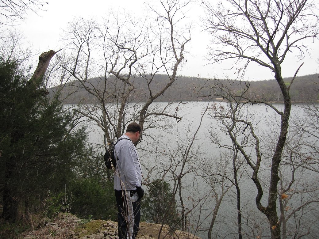 We'd stop every now and then so we could regroup. There was no need for hurrying. That's the philosophy of the group I lead. Russell ventures close to the edge. Slick rocks, Russ.
 Meanwhile, the fast group relentlessly forged on. Im not sure how far they were ahead, but they tipped off hikers along the way that our group was behind them We came across several groups of hikers who thought maybe we were speedsters ourselves, even chanting GO TATURs GO TATURs. Our Hello Kitty group shuffled along and still probably did not impress them. At one point, a hiker asked who TZ was, and that someone named Stormy said to trip him. HMPH!!! Pictured above the fasties pose with three hikers they met along the way.
 The fasties do occasionally take a break, as witnessed by these pix. Here, Rob, Brynna, and Travis rest, looking as if they have not even broken a sweat. Showoffs!
 The pix of Stormy and Company aka Fast Group, are courtesy of Travis, who posted 30 some-odd photos on Facebook. You might remember Travis from my Rocky Raccoon report. You'll see him again in future Pumpkin Holler reports. Meanwhile, the Hello Kitties kept picking off the miles. The vote was unanimous to not do an out-and-back, and around 4.5 miles out, we began the climb to the upper trail. At first, the climb was not a big deal at all. But after a mile, we began scaling hill after hill, coming way down through drainages each time.
 It seemed like each descent was followed by a worse ascent. While this was not Athens/Big Fork caliber hills, they were steep.
 To add insult to injury, it began to sprinkle, and then we had hail. Small hail, or huge sleet--you make the call. Fortunately, this form of precip did not last long.
 I was worried about a mutiny, as the trio of Tahlequah ladies were running a distance that was a little long for them, but every time I asked, they were good natured. There was a bail-out point where we could have cut off a couple of miles, but they wanted to complete the whole loop. I should admit, I thought the whole loop was only another mile at the bail-out, but it ended up being 2.5 more miles. This last section wound northward (away from the swinging bridge) up a holler to this waterfall. Pretty dry looking, huh? I have been here when the water was flowing, and it is postcard pretty.
 But we kept going. The last climb was mile in comparison to what we had previously dealt with and the last descent was runnable and fast. We had talked about how hungry we were getting. I like breakfast after a good morning trail run, but without driving way into Muskogee, there was only Charlie's Chicken in Fort Gibson. Chicken sounded wonderful to me though. I reckoned I could tear a chicken up.
 Seating was sparse, as it was 12:00ish when we rolled in, and the Baptists had taken over. Fried chicken is holy food in these parts. But we did get seated, and I had my fill.
 Yum. All the food was good, and even my vegetarian/vegan friends found something good to eat.
The plan for a few of us to go to Pumpkin Holler to run another 10 miles fell through. It seems everyone was a bit on the tired side, or had other engagements, so we scrapped that idea and headed home after refueling. Rob and I carpooled, and we almost solved all the remaining problems in the world by the time we made it home. I ended up going to Turkey Mountain for another 3ish miles and some geocaching. But that's another post.
No comments:
Post a Comment