Sunday, June 4, 2017

Devil's Den

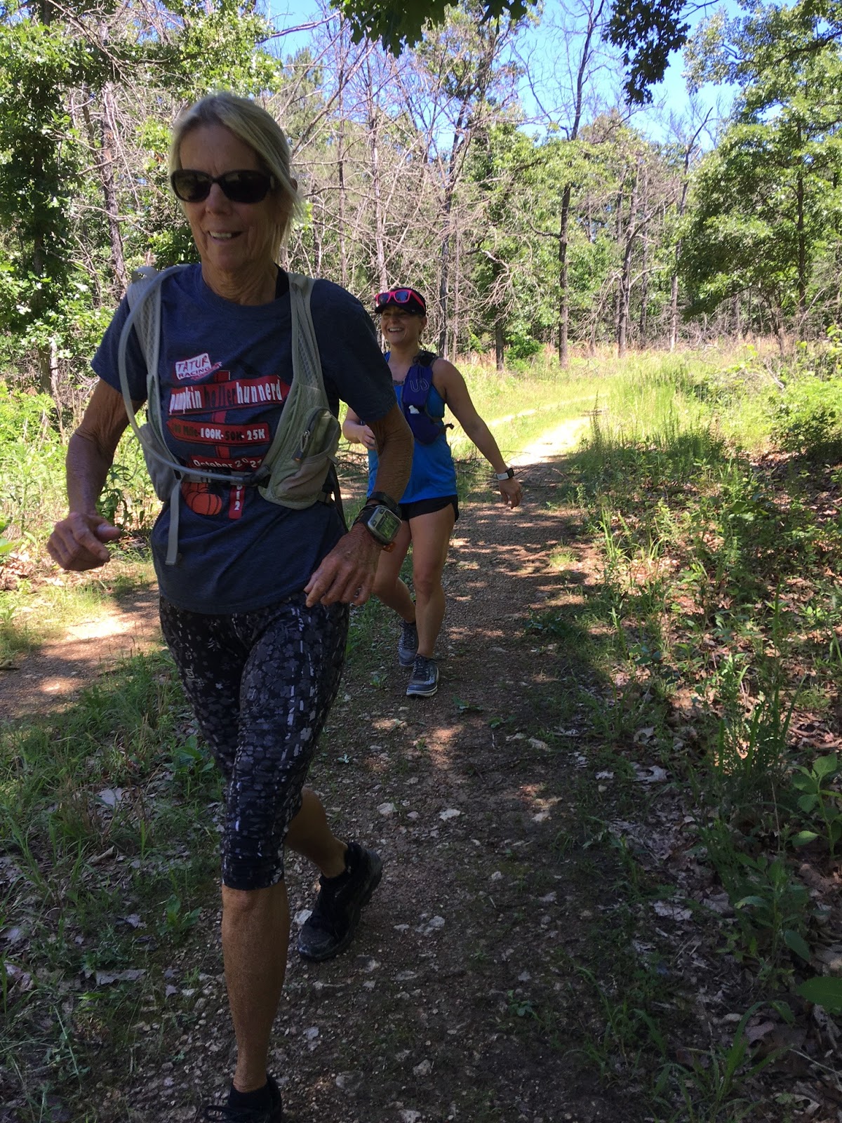
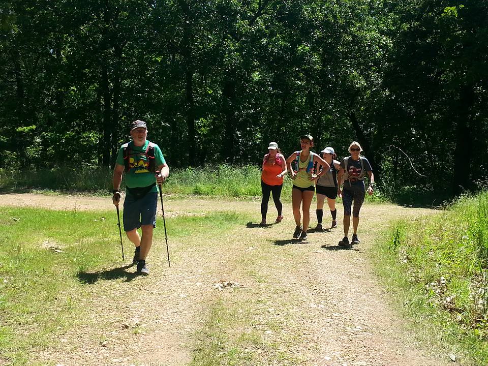
Our loosey-banded group of Sunday trail runners ventured east into the Boston Mountain Range in western Arkansas to run the Butterfield Trail. This was my 5th time to run the 15-mile loop trail, and our early start was thwarted by my dropped wallet as I scurried out of the hoses at 6:20 resulting in an extra trip back to the house, and of course a coffee stop and pee break along the way. Johnna, Alicia, and I picked up Lynna in Inola on the way, and Misty met us at the campground. We filled out a very detailed entry form for our free permits and took off around 9:45 with big plans for tackling all 15 miles of this rugged trail.

The map provided by the visitor center seemed accurate, but from a past experience with paper trail maps on a rainy day, I took a screen shot of it and hoped to keep my phone dry enough to access if needed.


The CCC built dam--the signature photo for the park--as flowing well and picturesque. We parked here and began a counter-clockwise trek around what is one of the oldest trailz in Arkansas. I have run the trail in both directions, and prefer this way because of a significant water crossing that is forded early in the loop when ran the other direction.

The sign at the trail head pointed us to this swinging bridge, and we headed left (south I think) but retraced our steps after a couple hundred yards as it seemed wrong to me. Actually, this is the finish of the loop when running it clockwise. Oh well--we had a Kodak moment on the bridge.


The trailz were well marked and maintained--much better than the last time I was here in 2008. That trip was plagued with downed trees, heavily overgrown trailz, and missing trail markers.


For the first mile or two, we ran along Lee Creek, a peaceful stream with an occasional small waterfall. This overlook was 20 feet above the water, and we considered the depth of the water below and ruled out jumping.

It had evidently rained during the night or early morning. The trail had a few muddy sections, but there was no problem keeping your feet dry. Any sloping rock and all fallen logs and exposed roots were trodden with caution as most were quite slick. The above pic was the start of a long climb--just under 500 feet of ascent in one mile.


Vistas like this were rare. The forest was dense and even if it were sunny, 99% of our run would have been in the shade. During this stretch, the trails greatly encroached with leafy undergrowth, an occasional brier, and pea-sized cockle burrs. We also began hearing distant thunder rumbling. At mile 4.5, it began to rain--lightly for a minute, and then the sky opened up.


We had just reached a boulder-strewn 95' descent. These moss covered rocks either had some grip if you were brave enough to trust it, or were slick as snot. The rocks were so big, my trekking poles were of no use, and despite the fair measure of caution exercised, I took a tumble and ended up on my back. It looked worse than it was. My fingers were bent back, but other than a very minuscule scratch, I was fine. I scurried on down to a flatter section where there was a huge rock overhang and crouched down under it to stay dry. 


There was room for all of us, and we waited out the rain for a while--long enough to eat a nibble or two of snacks, and soon the rain lessened and we resumed our journey.

The rain gods saw us on the move again and opened up the gates on us. It was glorious. Running in the rain is amazing. Once you get your shoes soaked, then no water puddle, no 30' long stretch of underwater trail, and no stream crossing is avoided. Plowing through becomes the procedure of choice.

The trail ran alongside this stream for a mile or so. I wad out and soaked my footsies, and wished I had a fly fishing rig. 


We found several primitive campsites alongside the stream--complete with all the amenities. A huge firepit, Flintstone-style furniture--chairs, couches, love seats, Johnna was relaxing in a sandstone recliner, and my chair had a stone swivel seat.


Lynna and I consulted the map. There was the single track trail, and also in places a 4-wheeler road or sorts. I wouldn't take a jeep down these roads, but those quad ATV could traverse the route easily. I am sot sure if these campsites are more for hunters, or backpackers. The park ranger told us that the campgrounds can be booked out a year in advance. I;m not sure if he means these places that are 5-8 miles from the park office.


The rain increased again, and we could hear the roar of the creek and saw that it had come up dramatically. In one place, we backtracked to take a look, and by then, it was a raging muddy river. Rushing water is a beautiful sight, but muddy water just does not have the same appeal.


At mile 10 we reached the bluffs. We rounded a hairpin turn to this waterfall. I had not seen water running here in my prior trips, and a little more rain might have made this a masterful sight.


A small box canyon ran upward from the base of the waterfall. This passageway was so inviting. I took a few pictures but few of then turned out. my lense was wet and I had nothing dry to wipe it off. 
This picture came out ok. The weird thing through here was that the ground was dry powder-like sand--like it had never rained.

On the far end of the box canyon, there was a narrow chute where with a little climbing you could squeeze through the end. There was also a way you could scramble up a bunch of loose boulders to the top. We might have explored these options but it was getting a little late.

The next 2.3 miles were uphill. Way uphill. We climbed 750 feet, but really it did not seem as bad as the climb earlier in the run. This ledge was a scenic overlook. I walked right over to the edge and looked down. Dizziness quickly followed. It was a good 80' down to the floor of the canyon below. I then laid down on my belly and inched over to the edge and took a few pictures downward. None really turned out, and none showed the frightening height. Someone had camped on this ledge. I'd advise not drinking if you were camping here.


We had made an executive decision to take the road back to our cars when we reached it. The trail crossed the road we came in on, and the intersection was on the highest point on the course. Taking the road meant two miles of paved, gradually descending switchbacks. This turned out to be a very good decision. 
When we got back to where we parked our cars, the little waterfall over the dam was now little Niagara. This meant the water crossing we would have hit a mile from the end of the Butterfield Loop would have been too dangerous to try. We would have had to either bushwhack for a mile along the riverbank to the main road or worse retrace our steps back up what would have been at least a 700-foot ascent and then run back on the main road. If this had happened, no amount of glossing over how cool bonus miles were would have saved me.

Back at the cars at last. Most everyone was all smiles Alicia had some sort of bug and was not feeling well. We rehydrated, ate a few snacks that Misty provided, put on whatever dry clothes we could find, and began our drive back home.
My Strava data. The route we took gave us about the same mileage we would have earned had we ran the last section of trail.


I'm proud of what we got done. 3281 feet is a good amount of climbing and certainly is what I need for my training.

Next weekend, we have Mowdy Mustang Run on Saturday. I will most likely run Sunday but will keep it closer to home.

Sunday, May 21, 2017

11 trail runners tackle Spavinaw WMA

For 5 consecutive weekends, I have done my semi-long runs with friends making road trips to run trailz we don't run all that often, and for most, ones they have never run.   Five weeks ago we visited lake Bixhoma and ran what single track is there, and then gravel and paved roads which conveniently included some hills. The heavy rains had some usually dormant waterfalls roaring, and it was quite a treat. The next week we ran at Keystone lake, doing a circuit on the mountain bike trailz and then a round at the state park on some entry level super easy routes. The next week we explored the newish mountain bike trailz at Claremore Lake, saw 7 snakes one of which was eating a rat, and collected a couple hundred ticks. Last week a few friends and I ran the Cavanal Killer 8K in Poteau. But we got there early and did a double-topper with almost 4000 feet of ascent. It's been fun, and our runs could legitimately be considered training--a novel concept for me. 

Today (Sunday if you are reading his over your Monday morning coffee) ten friends jumped on the bandwagon and we carpooled to Spavinaw to run some of the gravel access roads on the Wildlife Management Area (WMA).  

I've run there three times prior, and know the layout fairly well although I have not run every road and trail there. But from the ones that I DO know, I made a map showing a good selections or routes of various lengths. The map was a good map, but one of the roads that bisected the big north loop making a five-mile option was completely grown over and no one saw it. A few of our bunch was thinking of only doing a 5-miler, but everyone ended up with at least nine miles for the day. 

The day started going backward before we even started. I have run here before and never saw another human being all day. The Fischer family beat our caravan there by about 30 minutes and a park ranger informed them that we'd needed permits to be on the WMA. We could buy a two-day hunting or fishing license for 15 dollars or buy an annual one for $25. I had an expired one-year fishing license I'd bought last year so I could run at the Cookson WMA--and I bought it because the park ranger said I should have it. I have also ignored the requirement when I've run at the Sandy Sanders WMA where Do Wacka Do is and to my knowledge no game warden has ever shown up to check for illegals. But this ranger at Spavinaw seemed like a stickler to Christine, so they went ahead and signed u to fish. I advised the rest of our group to do the same. I bought the annual for $25, so I'm good anywhere in the state for a year. I think most of the rest of our group opted for the two-day license. Besides giving the State of Oklahoma around $200, we also burned at east an hour of our day.


Nobody looked unhappy though. We scrunched in together for a group selfie and then ambled northward onto a primitive gravel road.

The Fisher family Christine, Josh, and Katy, along with Russell took off like a flash, and I just hoped my map was sufficient for them to find their way around.

The rest of us leap-frogged our way around the loop. After a mile and a quarter, the road made a sharp left turn and the climbing began. 

I had run 16 miles the day before, and I was moving at my usual zombie pace. My walking sticks kept my pace steady even on the uphills, and after a while, I caught up with the pack.

Jessy ran around like a kindergartner zooming down the hills, running back u, and then zooming down again. She also took it upon herself to coach us into running and leaping over fallen trees.

For most of the run, the roads were perfect, In the drought years we have had, these gravel roads are so hard they seem to eat your feet up--but recent rains had these roads cushy soft.

We reached an intersection that seemed to me like where those running 5 miles need to turn left. I veered right and soon we saw runners coming toward us. It was none other than the Fisher family and Russell. This incorrect road did not show up on my mapping app, and as I mentioned earlier, the road that should have created the 5-mile loop was non-existent. I knew for a fact that a couple of years ago this connecting road was open and well groomed. Oh well.

The group behind me met us at the intersection, and this looks like a real mutiny, but it didn't seem like one to me at the time--maybe it was.

From that point on, everything seemed real familiar to me and I never questioned our location on the WMA.

Jessy took off like a shot just eating this nice gradual downhill. I stretched it out and caught up with her for a while but backed off when the descent became a little steeper. I decided to run back to check on the last couple of runners. As we neared the bottom of the descent, we heard chattering voices, crazy laughter, and it sounded like a party going on.

Jessy found a log laying across a washed-out ravine, and was daring anyone to walk across it. I gave it a try but it had just a wee bit too much wiggle to chance falling 6 feet into the rocky dry creek bed, so I bailed. 

Jessy pranced across, then took the dare to cross another bigger tree laying at a 45-degree incline.

Lynna then tried her luck at crossing the semi-rotted out log, Everybody escaped unscathed.

Now we were out of the hills and into a long valley. Three miles (ok maybe four miles) was all that was between us and where we parked, or so I thought.

I was not at all surprised to see that we had a water crossing. No problem here--I was able to fly across.

Well, this is our road. Russell and the fast group took this picture about an hour before we got there. 

The fisher plowed right on through it.

Russell evidently felt the shock of cold water. In places, the water was about the temperature of a nice nearly-freezing cold beer.

At first, our group was a bit tentative as to how they were going to cross through this area. 

I love a good water crossing--when it's not murky snaky foul smelling water. This stream was crystal clear--I would have drunk from it had I needed water.

So then the whole gang plowed in instead of trying to tramp through weeds alongside the creek.

It seemed like about a mile where there was more water walking than steps of dry land. 

From that point on, no one dreaded wet shoes--the almost icy water felt so good on our feet and legs. 

Water runs downhill, and we were walking upstream (or uphill) and eventually we ran out of water to tramp through.

But there had been some serious flooding here the past few weeks. This road washed out seems to be at least three feet thick. 

This waterfall ran over into a sink hole and who knows where it came out. 

We had our fair share of hills this day. The final climb actually started at the first water crossing and stretched for 3-ish miles ascending 350 feet. That doesn't seem all that bad, but 300 feet was in the last 1/4 mile.

I bit off chunks of the ascent and ran as much as I could. shuffling uphill is made so much easier with the trekking poles.

The final push--pretty steep, but runable if you're sick like that. 

A quarter mile down this hill put us back at the car. I did one run-back-up-and-down--technically a repeat. Russell, who finished way before my group did, did enough to legitimately call them repeats.

And of course, I love my Suunto and Strava data. I ended up with 1348 feet over 10.1 miles. This is a great place for training for a hard ultra. I will probably be back a couple of times before my fall 100. It'll most likely be heat-training since there is no running or hiking allowed during deer hunting season.But next tie I go, you should come with me.