Thursday, August 21, 2014

Paved Paradise

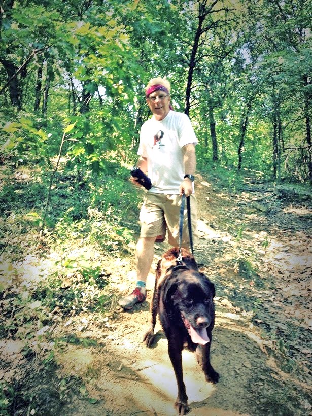
I took Jake for a walk last week, and took a picture of this flyer on a telephone pole at the end of my block. I didn't take time to read it, and forgot about it until today when I downloaded my pictures to my computer. This flyer--actually a copy of a page from the planitulsa.org website--calls for a meeting to discuss all of the proposed improvements in and around Tulsa Hills.  
Of course, I went to the website. (It's dot org, not dot com) in the name of improvement, it outlines countless development of the area I call home. Some of it it eerily close to out Turkey Mountain. The map below calls for business lining 71st Street, and lots of commercial buildings on the NW corner of 71st and Elwood. I spent about an hour trying to find out whatever I could. There is a long (100+ page) PDF, and some of the stuff in it may already be outdated or updated. The map below is a little more in focus. And that's not necessarily a good thing.  
All of the proposed improvements (except for the airplane) are huge houses, neighborhoods, and business complexes. Brings to mind the Joni Mitchell song BIG YELLOW TAXI. I won't post the video, although it is a good song, because most you probably wouldn't listen to it. But here are the words--read em. Other than the big yellow taxi taking away her old man, this fits.

                                    "Big Yellow Taxi"


They paved paradise
And put up a parking lot
With a pink hotel, a boutique
And a swinging hot SPOT
Don't it always seem to go
That you don't know what you've got
‘Til it's gone
They paved paradise
And put up a parking lot

They took all the trees
And put them in a tree museum
Then they charged the people
A dollar and a half just to see 'em
Don't it always seem to go,
That you don't know what you've got
‘Til it's gone
They paved paradise
And put up a parking lot

Hey farmer, farmer
Put away that DDT now
Give me spots on my apples
But LEAVE me the birds and the bees
Please!
Don't it always seem to go
That you don't know what you've got
‘Til its gone
They paved paradise
And put up a parking lot

Late last night
I heard the screen door slam
And a big yellow taxi
Come and took away my old man
Don't it always seem to go
That you don't know what you've got
‘Til it's gone
They paved paradise
And put up a parking lot

I said
Don't it always seem to go
That you don't know what you've got
‘Til it's gone
They paved paradise
And put up a parking lot

They paved paradise
And put up a parking lot
They paved paradise
And put up a parking lot


In all fairness though--reading through a few hundred pages--I did find at least a few encouraging things about their philosophy in their development. This one section set pretty well.

Regional Trails Master Plan 
Tulsa enjoys an interconnected system of bicycle and pedestrian trails maintained by several different entities including the City of Tulsa Parks Department, Tulsa Public Works Department, River Parks Authority, Broken Arrow Parks, Tulsa County Parks, Jenks Parks Department, the Town of Skiatook, and the City of Sand Springs. The city offers many north-south bike routes. The key trail corridors include the River Parks Trails from 11th Street to 101st Street (east bank) and from Southwest Boulevard to Turkey Mountain (west bank area); the Mingo Trail, the Osage Trail and the Creek Turnpike Trail. The current system of trails provides a solid foundation from which to expand and connect to underserved parts of the city and create a larger and more interconnected system to support bicycle and pedestrian travel and recreation throughout the region and the inner city. Tulsa’s comprehensive plan supports land uses and public improvements that will protect and enhance the city’s and region’s trail system. Regional open spaces, such as the Turkey Mountain Urban Wilderness Area, Mohawk Park, the Arkansas River, and other areas will be protected from development and enhanced with trails and paths so that the entire community can enjoy them. The Arkansas River will continue to be improved and preserved by storm water management and pollution control efforts, making it a valuable regional attraction for fishing, kayaking, canoeing, and other water sports.

Sunday, August 17, 2014

Lake McMurtry East Side

This is how it all started--this Red Dirt Shuffle idea.
Dana, Jake, and I spent the weekend at Lake McMurtry, but not where the LMTR 50K/25K/12K is. We camped on the EAST side and ran the trailz there--somewhere I have never been, which is odd--since I claim to be a trail guru.


I don't think these trailz are color-coded--other than on this map. While the west side trailz make a perfect 25K (we set the course up to get the whole 15.5 miles), the east side trailz add up to almost a perfect HALF MARATHON. Hmmm....


We are really enjoying our camping trailer. The heater works, and the A/C works as well. The old Ford does a great job pulling the trailer around--we got a whopping 9.3 MPG going out,. and 11 MPG coming back.


We tackled the south course on Saturday, although Jake and I ran 1.5 in the utter darkness with a small handheld LED light Friday night. I couldn't wait. The trailz were super smooth, soft, rockless, but rooty single track.


This dying tree begged for a picture, and I obliged.


Lotsa red dirt. Occasionally, the trail would cross an open area, and later in the day, the sun started to beat down on us a little. Hate to complain, since it was only maybe 73°.


Despite running sort of around the southern end of the lake, we never really got close enough for Jake to swim, but he did find a couple of creeks with enough water for a dip. Muddy puppy.


As on the west side, there are lots of prickly pear cacti.


Reminiscent of Huntsville State Park (Sunmart, Rocky Raccoon) there are a few wooden bridges to cross, but no alligators.


The trailz closet to the lake were fairly flat with just a few gentle ups and downs. On the return trip, we were a bit further up on the hill, and with the usual switchbacks that mountain bikers seem to like, we had a bit more climbing. The advertised mileage of 6.5 miles was a bit short by our Garmins.


The steeper hills and warming temps slowed TaturCakes and Jake down. I had to promise Jake a swim before we were through.


No Jake--that's not where you're swimming. This was some nasty water, and we would have needed a rope to pull him out.


With more walking than running in the final push, we made it out with close to 8 miles to show for it--which included the distance from our camp to the trail head to and from.

We grilled some steaks and baked potatoes and had a lunch for a king. Then, we made a trip into town. Jake has a hard time getting into the truck, and we have to help him (basically lift his heavy butt up.) We really tried everything to coax him up, and may have given him a complex, because when we got back, he would not walk up the steps into the camper. So, we lifted him up for that. I let him out later to pee, and he scampered out, but would not come back in. I got out the leash, and he got all excited like he does when he gets to go for a run, and was jumping around being the silly dog he is, but still would have no part of coming back inside. He wanted to go for a run or a walk, so I walked him. The tail was wagging and he was pulling wanting to run--not at all like a dog too tired to walk up two steps. So, we went for a walk/jog--taking it easy. Still, he would not come up the steps. We continued to operate a lift service for him, and wondered if he would be good to go the next day.


The question of whether he would/could/should run was heartily answered by him the next morning. He was pumped and stoked to go, acting like he was full of piss and vinegar--tail flying, and pulling on the leash.


Today's route was shorter according to the map. Jake got a swim about a mile into the run, and he ran like the energizer bunny from that point on. Dana ran better, and if we had put our Garmins on auto-pause, we probably would have averaged under 15 m/m. But with pee stops and picture stops, is was a good hiking pace at best.


We really liked the north trailz. The map showed a series of loops, and in my thinking, if we made all right turns, we would run all of the trail system. But instead of the two loops connected by out-and-back sections, there were 4-5 loops. I was confused by this, but still felt that all right turns would get us there.


The north trailz had more variety--a few meadows, straight sections, twisty-turny sections, a few rocky spots, and a lot more steep ups and downs.


We also had more wooden bridges.


The mountain bike club that built and maintains these trailz are to be commended. Besides constructing bridges over the drainages, they had areas where they had paved wash-outs with stone, and built berms to help with erosion.


In places, it seemed the trailz specifically sought out these rocky outcroppings, but still, even with the twisty undulating routes, it is an easier course than Turkey Mountain.


It was cooler today--or maybe it was because we set out an hour earlier.


Jake enjoys another swim. I need to video him--he moans and groans when he swims--like "oooohhh--that feels soooo good!"


The return trip was closer to the lake, and I figured Jake could get another swim in. It was a little more jungle-like, which gave the course even more character.


Trail running does not get much better than this.


While it was not as warm as yesterday, the sun was doing it's job. I got just a tad of sunburn, but hey--I'm super-white.


A tailing Jake is a thirsty Jake. We were carrying water for him--so no, our poor puppy never went without.


Along the bottom area near the lake, we ran through a section of reeds. This was co cool. Jake wanted to swim here, but we said no. Finally, we came to a rocky shore, and were gonna let Jake go hit the water, and Dana grabbed his collar just in time!!


He would have stepped right on this beauty. This girl was sunning herself right across the trail leading to the water, and made no effort at all to move. I came within 12 inches of her taking this picture, and she did that slight coil thing, and I quickly retreated. We thought it might have been a water moccasin, but upon seeing the tail, I doubted it. I could not tell if it had round eyes or slitted eyes, but in this picture shows round and it's tail was skinny to a long point. A moccasin has a blunt tail.

So Jake finished off his water, and was denied a third swim for the day.

We got home and were unloading the camper--and Jake was in and out and in and out, up and down the steps many times. He has some explaining to do.

We loved these trailz--I like them better that the west side, although those are fun as well. It's a great half marathon trail run. Hmmm....

Sunday, August 10, 2014

Warrior Princess Angel Run story


Last Saturday (and yes, I have been a little slow in getting my race report in--sorry) was the 5th running of the Warrior Princess Angel Run. This run is put in for a host of reasons.
1. It is a tribute to Lillian Grace Whitten, who is Michael and Chrissy Whitten's first daughter. Their website sums it up well, so I quote:
The Warrior Princess Foundation was founded by Michael and Chrissy Whitten after their precious daughter, Lilian Grace, earned her wings Thursday, August 5, 2010. She was born with T18, Edward’s Syndrome on Sunday, April 25, 2010, and fought a daily battle for 103 days. Her parents realized the need and desire to help other families going through this similar journey due to the large costs and grueling daily battles this syndrome creates on a daily basis.

2. Proceeds from the race benefit their foundation which helps build an awareness and helps with the needs of parents with children with to T18/T13 Edward's Syndrome.

3. Besides being a memorial to Lillian Grace and fundraiser to this to this cause, it is a great and fun trail run in an amazing park that most runners in the Tulsa area do not know exists.

4. Chrissy and I always look forward to hanging out for a day or two marking the race course and being silly. We've been good friends for years, but hardly get to see each other since we are both so stinking busy all the time.
Picture by Rafael Santiago
Chrissy made a few announcements, and hey--you had better be listening! The race was not a set distance--it was a timed race--how far can you run in 103 minutes. The actual course was an out-and-back that had a couple of loops within. Imagine a figure 8--with a squiggly out-and-back on the top and bottom end. Confusing? Well--you just needed to follow the person in front of you, and hope the leaders did not blow through an intersection without seeing the signs.

Picture by Rafael Santiago
The race started at 8:30, and the finishing gun was scheduled to fire at 10:13. Most of the crowd was more than ready to tear up some trail.

Picture by Rafael Santiago
We put up about 60 signs along the way--marking the course forwards and backwards. Putting wire signs into rock is tricky. I ran the course before race started, and none of the signs or pink ribbons had been disturbed since we placed them the day before. What a blessing!


Some of the route was runnable, but their were definitely some technical areas. My goal was to shuffle it all--and walk when I had to. I ran 7 laps last year, but this year, I had no goals other than to have fun and visit with friends. I ran one lap with Jason Bement for a while, and chatted it up with Bryan Carpenter for a bit before he left me in the dust. My second lap, I ran with Jenni Hawkins, and I think I have her re-hooked on trailz. My third lap, I ran with Terri Broomhall. Silly girl went the whole way in flip flops. 


Picture by Rafael Santiago
A few pics along the way--Sue Ann Bement extends her streak of running EVERY race in the Oklahoma Dirt Trail Series.


Chandler Park is a gem. The tall bluffs and tight hallways between them are mystifying to say the least. 


Picture by Rafael Santiago
This is a popular place for rock climbing, rappelling, and boulder hopping. (More on boulder hopping later.)


Terri picks her way thorough the rocks. 
Picture by Rafael Santiago 

Jason Bement cruises on his way back to the start/finish.


Just up this narrow rock stairway and we can see the Start/Finish checkpoint. 


But before we hit the starting table where they recorded your lap, there was one obstacle--a little boulder hopping across the LEAP of FAITH. Much like the LEAP O'DOOM at Lake McMurtry, one had to muster all the courage they had and pray that their jump would be enough to successfully reach the other side.


Actually--this is not quite as wide as the LEAP O'DOOM.


But it IS deeper. To verify this, I tossed a rope over the side, and then measured it. The measure told the tale--this crevice was just over 7 feet deeper than the chasm at Lake McMurtry.


Terri is green with fear with the idea of crossing.


Lap after lap--it was fun til the end. Katie Kramer seemed to just float over the rocks. She lapped me so many times I lost count.


I did 4 laps, and might have had time for a 5th lap if I ran a bit faster, but I called it a day. 


Picture by Rafael Santiago
According to the finishing times--it must have been a battle at the end, with Katie and Cameron Plate finishing right together.

Picture by Rafael Santiago
Cameron had a slight lead and took first place overall. It may get to be a common thing for Cameron and his brother Brandon winning our trail races. They make it look easy. Brandon also ran the 1.03 mile race (which started AFTER the big run), won it, and then started the 103 minute run late--and still finished 9 laps. In my way of thinking, Brandon would have been very near the lead had he not done the 1.03 mile run first.


This is a super cool trail race. My advice--go out to Chandler Park and just explore. And give this race a try next year.