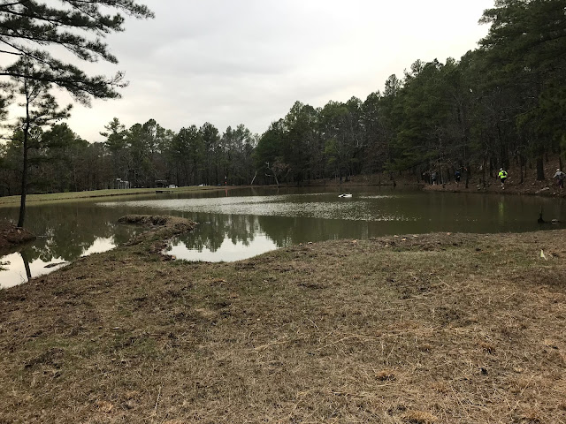
We had another trail outing Sunday--this time back at the Spavinaw WMA. I have run here several times, and each time I am intrigued at how many miles one could run if he had all day to do it. We met at RunnersWorld at 7:30 and picked up Lynna on the way through Inola. Our crew this time--Lynna and I, Kathy, Russell, and Caroll.
My intent was to try some different trailz than what we've been on before, but I could not resist starting the same way I always go. Not 1/4 of a mile into the first loop, we took a side-spur that turned out to be a dead end--but as is normal for trail runners, it was gladly accepted as bonus miles. At least now I know where that trail went. Very soon after that, we began what was a 213' ascent in .3 of a mile--basically a double Lipbuster. There had been a recent control-burn, and about half of our run we saw charred leaves and underbrush, and old deadwood smoldering. It was oddly beautiful.
The beauty of Spavinaw is everywhere. There is not a 'blah" spot anywhere. Yes, there are great hills, and nice crazy-fast descents, and enough flat sections to give the hill-haters something to feast on.
What I love about running here is the sound of wind whispering through the towering pine trees. That, and running on a carpet of pine needles.
Lynna and I found our happy pace as the the others were one notch faster than we were. But Russ, Caroll, and Kathy waited for us at each intersection. At the top of one such intersection there was a hollow but still standing tree with smoke drifting out of an open knothole near the top. We were just certain we had found the Keebler Elves tree, and cookies were-a-bakin'.
Now I know my way around at Spavinaw fairly well, and to me it looked like we needed to go right. But there was a sign (recently placed?) that said the right turn led to a private group camp which was down a long dead end road. So, we went left.
The road we took was a long glorious descent and we thundered down it. I was looking for the road to round a hill past a deep ravine to the right where I had previously spotted what looked like caves. But instead, our sweet downhill spilled out into a valley on what I was pretty sure was Ground Hog Hollow Road. It became clear to me that we should have went right at the Keebler Elf intersection.
My legs were agreeing with the running and I caught up with Russ and crew. He was looking at the map he had on his phone and had figured out the same thing I had. No matter, because I wanted to see different stuff anyway.
Lynna decided to take Ground Hog back to where we parked, and the rest of us decided to go south, or west, or somewhere. That's when I looked up and saw what looked like a leprechaun beckoning us to try a mysterious route into the woods. We thought for a second and then--well--why not?
This nice lesser-travelled dirt road led in a southeast direction past a couple of fields that were no doubt planted to fatten up deer for the hunters who like to shoot them in the fall. This IS a Wildlife Management area anyway.
During our whole run, I never saw ANY wildlife. I'm sure they are there, but well hidden.
Our road fizzled to almost nothing resembling a route, but we followed what looked like a rarely used 4-wheeler trail. It eventually turned back into a maintained gravel road, and to a T-intersection where we had the choice of going west and tackling another huge loop, or go right and run into the paved highway where we could pop right back into the woods on another lesser-used road. Since my stomach was growling, I voted for the shorter route back. It was inching past lunchtime.
The next couple of miles were mostly downhill, and we finally spilled onto Ground Hog Hollow, and took what I thought was the final ascent and descent to where we parked. I was wrong, as to took us to the Keebler Elf tree. That's still puzzling. We went left, and it was mostly downhill from there including a super steep loosely-graveled final stretch.
I ended up with 12 miles. Lynna had got back to the car and did hill repeats while she was waiting on us. Russell being the overachiever that he is, put his Iron Horse signature on the run by repeating the last hill.
We hit the Country Cottage in Locust Grove on the way home, and replaced every calorie we burned on our run. It was a satisfying day to say the least.
Next trip--in a few weeks--maybe McGee Creek.


